(Titelbild evtl. abweichend)
 Altauflage 2012, daher zum Sonderpreis. Der WanderfÞhrer beinhaltet ein umfangreiches Kartenmaterial zu den einzelnen Etappen. Es sind ebenfalls umfangreiche bebilderte Informationen zu Kultur, Geschichte sowie touristischen SehenswÞrdigkeiten enthalten. Alle Texte und Beschreibungen komplett in franzÃķsischer Sprache. TitelÞbersicht:  Nordwest Nordost Nordwest Nordost
SÞdwest SÞdost Klicken Sie hier, wenn Sie diesen Artikel in der Version zum normalen Preis sehen möchten. Kartenausschnitt
Kartenbeispiel
|
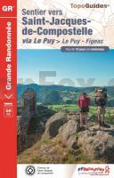
SAINT-JACQUES-DE-COMPOSTELLE via Le Puy - Figeac GR65 (Jakobsweg) *** SCHNÃPPCHEN *** - RÃĐf. 0651 Topographischer WanderfÞhrer - FFRP (FÃĐdÃĐration française de randonnÃĐe pÃĐdestre) Frankreich
Sentier vers Saint-Jaques-de-Compostelle
EAN / ISBN: 9782751413445
Preis: EUR 10.00
|
| 


