Willkommen bei MapFox
Wurde Ihre Bestellung bestätigt? Wenn nicht - gab es evtl. ein SERVER-Problem! Bitte kontaktieren Sie uns! +++ Buchhändler-Anfragen erwünscht +++
Warenkorb
Artikel: 0 - € 0.00
Zur Kasse
Widerruf Impressum Kontakt Versandkosten AGB
A Pilgrim`s Guide to the Camino Sanabrés & Camino Invierno by John Brierley Caminoguides - Findhorn Press
<< Caminoguides - Jakobsweg
<< Jakobsweg
 
Cover

144 pages paperback in full colour including:

- Overview route planners
- Daily stage maps
- Contour guides
- Alternative routes & detours
- Detailed town plans
- List of all pilgrim hostels & hotels
- Historical notes
- Myths and Legends?

This guidebook combines two ancient routes into Santiago that remain largely undiscovered despite their historic significance. Each route offers a very different camino experience but are combined in one volume as they join in A Laxe for the final stages. Each provides the minimum distance required for a pilgrim to apply for a Compostela; but that is not the purpose of this guidebook which seeks to off er alternatives to the busy routes through Sarria and Tui which account for over 80% of all pilgrims to Santiago; by contrast the Camino Invierno currently carries less than 1%.

Camino Sanabrés offers a link from the Via de le Plata. This guide offers the last 5 stages of that itinerary commencing in Ourense with its rich Roman heritage and extant thermal baths. Excellent rail and road links make the city highly accessible for pilgrims wishing to commence their journey from this point. The acorn would be a fitting symbol for this route that winds its way through ancient oak forest past the Pico Santo into Santiago.

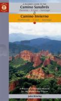
Camino Invierno provides a link from the Camino Francés and a wonderful alternative to the routes through Sarria which carry such a large volume of pilgrims. The ?Winter Way’ is a camino in its own right as it snakes its way through the mystery of Las Médulas, the largest gold mines in the Roman Empire and now a World Heritage Site (see cover photo). It continues along the sacred banks of the río Sil, the incomparable Ribeira Sacra with its vineyards and chestnut forests. Its remote location and limited facilities make this a demanding route, well suited for the seasoned pilgrim with an adventurous spirit, seeking a quieter way.

This guidebook also seeks to find a balance between the outer and inner journey, between the physical and spiritual, which is why it is subtitled A Practical & Mystical Manual - that we might find a place to eat and sleep at the end of a hard day’s walk but also, and crucially, that we might find the courage to dive into the mystery of our own soul awakening.

A Pilgrim`s Guide to the Camino Sanabrés & Camino Invierno by John Brierley Caminoguides - Findhorn Press
EAN / ISBN: 9781912216260
Preis: EUR 22.90

Bestellartikel: versandfertig in ca. 2 Wochen oder länger. Dieser Artikel wird speziell für Sie bestellt. Keine Rücknahme!
Produkt EUR Anzahl Bestellen
A Pilgrim`s Guide to the Camino Sanabrés & Camino Invierno by John Brierley Caminoguides - Findhorn Press 22.90
Versandkostenfrei in Deutschland ab 30,- Bestellwert

incl. MwSt.

Stichworte, die bei der Suche nützlich sein könnten:
Way of St. James - Jakobsweg - Jakobsweg Spanien - Camino de Santiago - Jakobsweg - Camino de Santiago - Santiago de Compostela - Camino Primitivo - Camino Portugués - Camino Portugues - Camino Portugués - John Brierley - Findhorn Press - Jakobsweg - Santiago-de-Compostela - Santiago de Compostela - Santiago de Compostella

Zuletzt angesehene Artikel:

CoverA Pilgrim`s Guide to the Camino Sanabrés & Camino Invierno by John Brierley Caminoguides - Findhorn Press

CoverTour del Monte Bianco - Tour du Mont Blanc - Il grande classico tour della Alpi tra France, Italia e Svizzera - Topographischer Wanderführer - Geo4 Map - Italien

CoverGlan-Blies-Radweg (Nr. 7035) Fahrrad-Tourenkarte. GPS-genau. 1:50.000 KOMPASS-Karten

CoverPeak District (Süd) Wanderkarte 1:25.000 Superwalker XT25
Peak District South - Hiking map HARVEY MAPS

CoverSareks nationalpark Fjällkartan - Bergwanderkarte 1:50.000 Calazo Förlag Schweden

Cover329 Lowther Hills - Sanquhar & Leadhills - Wanderkarte Großbritannien 1:25.000 EXPLORER MAP - Ordnance Survey

CoverMARCO POLO Regionalkarte Nordfrankreich / Ile-de-France, Normandie-Ost, Picardie

Cover071 Lanark & Upper Nithsdale - Wanderkarte Großbritannien 1:50.000 Active Laminiert LANDRANGER MAP - Ordnance Survey

CoverYorkshire Dales for cyclists - Radwanderkarte 1:100.000 wasserfest
Yorkshire Dales Cycle Touring Map XT100 Harvey Maps - Großbritannien

Cover168 Stroud - Tetbury & Malmesbury - Wanderkarte Großbritannien 1:25.000 EXPLORER MAP - Ordnance Survey

CoverKarakoram Maps: Skardu - Hispar - Biafo Gebiet - Trekkingkarte (engl.) 1:200.000 (Blatt LMK 2) Leomann Maps

CoverLexington - Blue Ridge Mountains - George Washington and Jefferson National Forests 1:75.000 (Blatt: 789) Landkarte Trails Illustrated Topographic Map National Geographic - USA

CoverL2908 Bunde Amtliche topographische Karte 1:50.000 Landesvermessungsamt Niedersachsen

CoverL3122 Walsrode Amtliche topographische Karte 1:50.000 Landesvermessungsamt Niedersachsen

CoverRefuges des Ecrins - Rando à pied - Auvergne-Rhône-Alpes Wanderführer - (französisch) Chamina - Frankreich

Noch kein Cover vorhanden8414 Laufenburg (Baden) Topographische Landkarte 1:25.000 - Landesvermessungsamt Baden-Württemberg

CoverL3522 Garbsen Amtliche topographische Karte 1:50.000 Landesvermessungsamt Niedersachsen

CoverStubaital und Wipptal - Wanderführer (Nr. 5610) mit Gschnitz, Obernberg, Navis, Schmirn, Vals, 65 Touren - KOMPASS

Cover65/5-6 NEUFCHATEAU - VAUX-SUR-SURE NGI 1:25.000 Topographische Landkarte Belgien

CoverTauferer Ahrntal, Valle di Tures e Aurina (Nr. 82) 1:50.000 - Wanderkarte mit Broschüre KOMPASS
