 These attractive and cleverly structured guides give walkers ten of the finest walks along each of the main sections of the Wales Coast Path in a popular pocketable format.
With clear information, an overview and introduction for each walk, expertly written numbered directions, large scale Ordnance Survey maps, superb eye-grabbing panoramic photographs, and interpretation of points of interest along the way, these guides set a new standard in clarity and ease-of-use.
Featured walks include: Porthmadog & Moel y Gest, Portmeirion, Ynys Llanfihangel-y-traethau, Harlech beach, Shell Island, Dyffryn Ardudwy, Barmouth & Arthog, Barmouth Panorama, Aberdyfi and Borth & Wallog.  Kartenausschnitt Kartenausschnitt
Kartenbeispiel
|
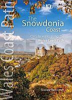
Snowdonia - Top 10 Walks Series Circular walks along the Wales Coast Path - Sioned Bannister
EAN / ISBN: 9781908632852
Preis: EUR 14.90
|
|


