 The Coast to Coast Path runs for nearly 200 miles (320 km) from St Bees on the Irish Sea across the width of Northern England to the North Sea at Robin Hood`s Bay.
This spectacular two-week walk crosses three National Parks - the Lake District, the Yorkshire Dales and the North Yorkshire Moors.
The guidebook contains all the information you need. The hard work has been done for you so you can plan your trip from home without the usual pile of books, maps and guides.
Unique mapping features - walking times, directions, tricky junctions, places to stay, places to eat, points of interest. These are not general-purpose maps but detailed route guides drawn by walkers for walkers.
Includes 109 walking maps: the largest-scale maps available - At just under 1:20,000 (8cm or 3-1/8 inches to 1 mile) these are bigger than even the most detailed walking maps currently available.
Itineraries for all walkers - whether hiking the entire route over two weeks, or sampling the highlights on day walks or short breaks.
- Downloadable GPS waypoints.
- Practical information for all budgets - what to see, where to stay, where to eat: B&Bs, hotels, campsites, bunkhouses, hostels, pubs.
- Detailed public transport information - for all access points
- Includes 31 town and village guides - where to stay, where to eat, transport information.  Übersicht der Trailblazer Wanderführer Großbritannien Übersicht der Trailblazer Wanderführer Großbritannien
Kartenausschnitt
Kartenbeispiel
|
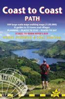
Coast to Coast Path (St. Bees to Robin Hood´s Bay) Wanderführer englisch - Trailblazer
EAN / ISBN: 9781912716258
Preis: EUR 23.50
|
|


