| << Irland: Wanderkarten verschiedener Verlage |
||
|
||
Zuletzt angesehene Artikel:
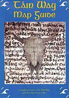
 | Tain Way (Halbinsel Cooley, Irland) Wanderkarte 1:50.000 Inkl. Führer - East West Mapping The Tain Way Map Guide (near Cooley & Carlingford) - folded map in plastic sleeve |
 | Märkische Schweiz Topographische Wanderkarte mit Wanderwegen und Radwegen 1:30.000 - ProjektNord |
 | 026 Prealpi Giulie - Valli del Torre Topographische Wanderkarte 1:25.000 - Casa Editrice Tabacco - Italien |
 | Palästinensisch-Syrisch-Arabisch - Wort für Wort Kauderwelsch-Sprachführer (Band 075) Reise-Know-How Verlag |
 | 225T ZÃRICH - Seetal - Reusstal - Albis 1:50.000 Topographische Wanderkarte SAW der Schweiz - swisstopo |
 | 2215-I Hammershøj Topographische Karte Dänemark 1:50.000 - Kort & Matrikelstyrelsen ProjektNord |
 | M-33-143-C Bratislava Amtliche Topographische Karte Ungarn 1:50.000 |
 | Spanisch für Guatemala - Wort für Wort Kauderwelsch-Sprachführer (Band 083) Reise-Know-How Verlag |
 | L3112 Werlte Amtliche topographische Karte 1:50.000 Landesvermessungsamt Niedersachsen |
 | 214 Llanidloes & Newtown / Y Drenewydd - Wanderkarte GroÃbritannien 1:25.000 EXPLORER MAP - Ordnance Survey |
 | 04 Udine - Palmanova 1:25.000 Radwanderkarte, Wanderkarte und Reitkarte - Libreria Editrice Odos - Italien |
 | 06 Udine - Cividale 1:25.000 Radwanderkarte, Wanderkarte und Reitkarte - Libreria Editrice Odos - Italien |
 | L2910 Papenburg Amtliche topographische Karte 1:50.000 Landesvermessungsamt Niedersachsen |
 | 214 Llanidloes & Newtown / Y Drenewydd - Wanderkarte GroÃbritannien 1:25.000 EXPLORER MAP - Active Map LAMINIERT - Ordnance Survey |
 | 27 Parang-Gebirge StraÃenkarte und Wanderkarte Rumänien 1:50.000 Muntii Parang / Parang Mountains Dimap |
 | Teide Nationalpark - Wanderwegnetz 2 Wanderkarten + Guide 1:25.000 Nationalparks Spanien - Teide Nationalpark Teide PN - Red de Senderos - Parques Nacionales CNIG Spanien |
 | 2215-III Topographische Karte Dänemark 1:50.000 - Kort & Matrikelstyrelsen ProjektNord |
 | 3948 Oderin Topographische Karte 1:25.000 Landesvermessungsamt Brandenburg (gefaltet) |
 | Walking the Munros - Volume 2: Northern Highlands and the Cairngorms Wanderführer Schottland - Cicerone GroÃbritannien (englisch) |
 | Keski-Suomen kansallispuistot 1:25.000 Terrängkarta Wanderkarte Finnland - Calazo Förlag |