Willkommen bei MapFox
Wurde Ihre Bestellung bestätigt? Wenn nicht - gab es evtl. ein SERVER-Problem! Bitte kontaktieren Sie uns! +++ Buchhändler-Anfragen erwünscht +++
Warenkorb
Artikel: 0 - € 0.00
Zur Kasse
Impressum Kontakt Versandkosten AGB
The GR5 Trail - Through the French Alps: Lake Geneva to Nice Wanderführer Frankreich - Cicerone (englisch)
<< Frankreich: Wanderführer und Reiseführer allgemein
<< Cicerone
 
Cover

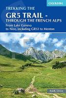
The GR5 is one of the world’s most spectacular long-distance trails, but at the same time well within the reach of moderately experienced walkers and backpackers. There is good signposting and waymarking, plus lodgings, food and drink are all available at regular intervals. The paths and tracks are generally well graded, while steep climbs are tackled on zigzag paths, so the overall gradient is not so severe. These numerous benefits mean that every summer, thousands of walkers embark on this trek.

It makes its way through the Alps from the shores of Lac Léman at Geneva to the Mediterranean at Nice, following a route of 674km (420 miles) on well-graded and well-marked paths and tracks. The route can be trekked in a month, or it can be split over a series of summer trips to prolong the enjoyment. Good public transport links across the length of the trail mean that it is easy to divide the trek into several separate trips.

Kartenausschnitt

The GR5 Trail - Through the French Alps: Lake Geneva to Nice Wanderführer Frankreich - Cicerone (englisch)
EAN / ISBN: 9781852848606
Preis: EUR 28.90

Bestellartikel: versandfertig in ca. 3-7 Tagen. Dieser Artikel wird speziell für Sie bestellt. Keine Rücknahme!
Produkt EUR Anzahl Bestellen
The GR5 Trail - Through the French Alps: Lake Geneva to Nice Wanderführer Frankreich - Cicerone (englisch) 28.90
Versandkostenfrei in Deutschland ab 30,- Bestellwert

incl. MwSt.

Stichworte, die bei der Suche nützlich sein könnten:
Nizza - GR5 - Französische Alpen - Lake Geneva - French Alps - Genfer See - Nice - Cicerone - Cicerone Radwanderführer - Cicerone Wanderführer - Großbritannien Radwanderführer - Großbritannien Wanderführer - Cicerone Großbritannien - Frankreich Wanderführer - Frankreich Reiseführer

Zuletzt angesehene Artikel:

CoverThe GR5 Trail - Through the French Alps: Lake Geneva to Nice Wanderführer Frankreich - Cicerone (englisch)

Cover035 Kingussie and Monadhliath Mountains - Wanderkarte Großbritannien 1:50.000 LANDRANGER MAP - Ordnance Survey

Cover201 Knighton Presteigne - Wanderkarte Großbritannien 1:25.000 *** SCHNÄPPCHEN *** EXPLORER MAP - Ordnance Survey

Cover062 North Kintyre & Tarbert - Wanderkarte Großbritannien 1:50.000 LANDRANGER MAP - Ordnance Survey

CoverSouth West Coast Path 1:25.000 (4): South Devon Wanderkarte Geographers` A-Z Großbritannien

Cover206 STEIN AM RHEIN 1:50.000 - Diessenhofen - Singen - Steckborn - Topographische Landeskarte der Schweiz - swisstopo

CoverMallorca Nord - Wandern und Radfahren mit 2 Wanderkarten + Führer 1:25.000 Mallorca (englisch) ALPINA

CoverSilagebirge (Kalabrien) Touristische Straßen- und Wanderkarte 1:100.000
La Sila L.A.C. GlobalMap Italien

CoverTunesien Straßenkarte 1:800.000
Tunisia Internationale Landkarte IGN

CoverDuMont Reise-Handbuch Reiseführer Kanada, Der Osten mit Extra-Reisekarte - von Ohlhoff, Kurt Jochen - DuMont Reiseverlag

CoverAbenteuer Allgäu 2 - Unterallgäu - Ostallgäu - Tannheimer Tal Freizeitführer für unternehmungslustige Familien - AVA Agrar-Verlag Allgäu

CoverPérigord - Wanderführer 22 Spaziergänge + 1 Wanderung - Balades & Circuits - OUEST France - Frankreich
Périgord - 22 balades + 1 randonnée

CoverRund um den Hochkönig 60 Touren im Steinernen Meer, im Tennengebirge und den Steinberge. Mit GPS-Tracks - Rother Wanderführer - Bergverlag Rother

CoverGöttingen - Oberes Leinetal ADFC-Regionalkarte 1:75.000 BVA Bielefelder Verlag

Cover10172 Neiden Topographische Landkarte 1:50.000 Norge-serien - Nordeca Norwegen

CoverBrest Stadtplan - 1:21.000 Weißrussland
Brestskij rajon Belkartografia

CoverEmilia-Romagna incl. Bologna (Northern Italy) Reiseführer (englisch) Bradt Publications

CoverZugspitze - mit Ammergauer Alpen und Werdenfelser Land - Rother Wanderführer von Dieter Seibert - Bergverlag Rother

CoverPacific Crest Trail - Sierra Nevada North 1:75.000 (Blatt 1008) - Sierra Buttes to Devils Postpile Topographic Map Guide - USA National Geographic

CoverUnsere Zukunft Ein Gespräch über die Welt nach Fukushima - von Klaus Töpfer, Ranga Yogeshwar - Beck Verlag