Willkommen bei MapFox
Wurde Ihre Bestellung bestätigt? Wenn nicht - gab es evtl. ein SERVER-Problem! Bitte kontaktieren Sie uns! +++ Buchhändler-Anfragen erwünscht +++
Warenkorb
Artikel: 0 - € 0.00
Zur Kasse
Widerruf Impressum Kontakt Versandkosten AGB
The Severn Way - 210 miles from the river Severn´s source in Powys to Severn Beach near Bristil Wanderführer (englisch) Cicerone Großbritannien
<< Großbritannien: Wanderführer + Kletterführer
<< Cicerone
 
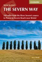
Cover

The 210 miles of the River Severn, the UK’s longest river, run from the heights of Plynlimon in mid-Wales down to the Bristol Channel at Severn Beach, through the historic counties of Shropshire, Worcestershire and Gloucestershire.

As well as a largely downhill walk through peaceful landscapes such as the superb Hafren Forest, easily accessible from the pretty towns along the route, the Severn Way, which follows its course, is also a packed with historical and geographical interest.

The Severn Way can take more than three weeks to walk. There is however, much to be said for tackling the Way over a number of visits. For example from the source at Plynlimon to Shrewsbury; Shrewsbury to Bridgenorth; Bridgenorth to Tewskesbury; Tewkesbury to Severn Beach,

Divided into four sections that correspond with the four main counties (Powys, Shropshire, Worcestershire and Gloucestershire) through which the River Severn flows, this guidebook offers all the information walkers need to make the most of their backpacking trip, from source to sea.

Kartenausschnitt

The Severn Way - 210 miles from the river Severn´s source in Powys to Severn Beach near Bristil Wanderführer (englisch) Cicerone Großbritannien
EAN / ISBN: 9781786311405
Preis: EUR 25.90

Bestellartikel: versandfertig in ca. 3-7 Tagen. Dieser Artikel wird speziell für Sie bestellt. Keine Rücknahme!
Produkt EUR Anzahl Bestellen
The Severn Way - 210 miles from the river Severn´s source in Powys to Severn Beach near Bristil Wanderführer (englisch) Cicerone Großbritannien 25.90
Versandkostenfrei in Deutschland ab 30,- Bestellwert

incl. MwSt.

Stichworte, die bei der Suche nützlich sein könnten:
The Severn Way - Cicerone - Cicerone Radwanderführer - Cicerone Wanderführer - Großbritannien Radwanderführer - Großbritannien Wanderführer - Cicerone Großbritannien - Großbritannien - Großbritannien Wanderführer - Großbritannien Trekkingführer - Großbritannien Klettern - Großbritannien Kletterführer

Zuletzt angesehene Artikel:

CoverThe Severn Way - 210 miles from the river Severn´s source in Powys to Severn Beach near Bristil Wanderführer (englisch) Cicerone Großbritannien

CoverLivingston (West Lothian) Fahrradkarte 1:15.000 HARVEY MAPS
Livingston (West Lothian) for Cyclists

Cover3312 Berge Topographische Wanderkarte 1:25.000 Niedersachsen mit Wanderwegen - ProjektNord

CoverCammina Foreste in Lombardia - 750 chilometri dal Po al monte Resegone - Wanderführer (italienisch) - TERRE DI MEZZO

Noch kein Cover vorhanden2115SB Épernon - Nogent-le-Roi - Houdan GPS Amtliche Topographische Wanderkarte Frankreich 1:25.000 - série bleue (IGN)

Cover1208 BEATENBERG 1:25.000 - Sigriswil - Habkern - Interlaken - Topographische Landeskarte der Schweiz - swisstopo

Cover2243 Ivenack Amtliche Topographische Karte 1:25.000 Landesvermessungsamt Mecklenburg-Vorpommern

CoverFinistère per Fahrrad Fahrradkarte 1:110.000
Le Finistère à velo IGN Frankreich

Noch kein Cover vorhanden7738 Dorfen Topographische Landkarte Bayern 1:25.000 (Normalausgabe - Atkis) Landesvermessungsamt Bayern

Cover1072 WINTERTHUR 1:25.000 - Pfungen - Wiesendangen - Turbenthal - Topographische Landeskarte der Schweiz - swisstopo

Cover24 Valle Orco Gran Paradiso (wasserfest) Topographische Wanderkarte und Straßenkarte 1:25.000 Fraternali Editore - Italien

CoverL42 Topographische Karte 1:100.000 EUREF-FIN Maanmittauslaitos / Lantmäteriverket Finnland - ProjektNord

CoverR5224 Puhos Topographische Karte 1:25.000 EUREF (Peruskartta) Maanmittauslaitos / Lantmäteriverket Finnland - ProjektNord

CoverKuwait Landkarte 1:390.000 und Kuwait-Stadt Stadtplan 1:15.000 (engl.)
Kuweit and Kuweit City ITMB International Travel Maps (engl.)

Cover3653 Frankfurt (Oder) Topographische Karte 1:25.000 Landesvermessungsamt Brandenburg (gefaltet)

CoverL1738 Graal-Müritz Amtliche Topographische Karte 1:50.000 Landesvermessungsamt Mecklenburg-Vorpommern

Noch kein Cover vorhanden2 Holstein - Hamburg *** SCHNÄPPCHEN *** ADFC-Radtourenkarte 1:150.000 Bielefelder Verlag

Cover2411 Blomberg Amtliche topographische Karte 1:25.000 Landesvermessungsamt Niedersachsen

CoverL5928 Haßfurt (geplottete Ausgabe) Topographische Karte Bayern 1:50.000 Bayerisches Landesvermessungsamt

CoverL`Anjou 1592 Historische Landkarte auf Pergament (Faksimile) - 50 x 37,5 cm - PLANO gerollt Antica
