Willkommen bei MapFox
Wurde Ihre Bestellung bestätigt? Wenn nicht - gab es evtl. ein SERVER-Problem! Bitte kontaktieren Sie uns! +++ Buchhändler-Anfragen erwünscht +++
Warenkorb
Artikel: 0 - € 0.00
Zur Kasse
Impressum Kontakt Versandkosten AGB
The Pyrenees The High Pyrenees from the Cirque de Lescun to the Carlit Massif - Wanderführer - Cicerone (englisch)
<< Frankreich: Pyrenäen
<< Spanien: Pyrenäen
<< Cicerone
 
Cover

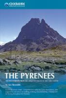
The guide describes the High Pyrenees from the Cirque de Lescun in the west to the Carlit massif and Cerdagne east of Andorra, in five regional chapters.

The guide contains:

  • Valley-by-valley descriptions of range, its facilities and infrastructure
  • Information on the best mountaineering, walking and climbing opportunities in the area
  • Summaries of long-distance through-routes and treks
  • Accommodation, camping, refuges and travel details
  • Extensive introductory materials on the region, climate, geology, structure, towns, villages, access, best regions
  • History and background of the great explorations, with profiles of the pioneers and personalities of each range
  • A full listing of all the Pyrenean 3000m summits and their location
  • Detailed sketch maps and excellent colour photographs.
  • Kartenausschnitt

    The Pyrenees The High Pyrenees from the Cirque de Lescun to the Carlit Massif - Wanderführer - Cicerone (englisch)
    EAN / ISBN: 9781852844202
    Preis: EUR 33.90

Bestellartikel: versandfertig in ca. 3-7 Tagen. Dieser Artikel wird speziell für Sie bestellt. Keine Rücknahme!
Produkt EUR Anzahl Bestellen
The Pyrenees The High Pyrenees from the Cirque de Lescun to the Carlit Massif - Wanderführer - Cicerone (englisch) 33.90
Versandkostenfrei in Deutschland

incl. MwSt.

Stichworte, die bei der Suche nützlich sein könnten:
Cirque de Lescun - Pyrenees - Carlit Massif - Cicerone - Cicerone Radwanderführer - Cicerone Wanderführer - Großbritannien Radwanderführer - Großbritannien Wanderführer - Cicerone Großbritannien - Pyrenäen - Pyrenäen - Pyrenäen Wanderführer

Zuletzt angesehene Artikel:

CoverThe Pyrenees The High Pyrenees from the Cirque de Lescun to the Carlit Massif - Wanderführer - Cicerone (englisch)

CoverUSA Nordwesten / Kanada Südwesten Reiseführer Reise-Know-How Verlag

CoverOberschwaben 53 Touren - Zwischen Donau - Bodensee und Iller - Rother Wanderführer - Bergverlag Rother GPS

CoverBISHKEK CENTRAL AISA 1:500.000 Central Asia Maps - Bishkek EWP WEST COL PRODUCTIONS

CoverNew Brunswick 1:360.000 Landkarte - ITMB International Travel Maps (engl.)

Noch kein Cover vorhandenBåtsportkort Bottenhavet Norra - Sjöfartsverket

Noch kein Cover vorhandenPANORAMAKARTE von DANZIG Posterversion Posterversion in Plastikhülle (82 x 65 cm) - Terra Nostra Polen

CoverTasmanien Straßenkarte 1:500.000
Tasmania State Map HEMA Maps - Australien

CoverCleveland Way A-Z Adventure Atlas Map 1:25.000 Wanderkarte Geographers` A-Z Großbritannien

CoverEl Montgó - Parc Natural Wanderkarte 1:25.000 - Editorial Piolet - Spanien

CoverZentralschweizerische Voralpen Alpinführer Schweizer Alpen Schweizer Alpen-Club

CoverAllein im Wald - Survival für Kinder OutdoorHandbuch - Basixx - Colleen Politano Conrad-Stein-Verlag

CoverProssnitz 1:12.000 Stadtplan
Prostejov a Okoli SHOCart Tschechien

CoverOsnabrück 1970 (Blatt 108) Historischer Bildstadtplan Bollmann-Bildkarten-Verlag

Cover23 MAYO Wanderkarte Irland 1:50.000 DISCOVERY MAP - Ordnance Survey

CoverSalzburg 1:7.500-1:15.000 Stadtplan Freytag & Berndt

CoverHaute Route - Chamonix to Zermatt 1:50.000 (Blatt 4001) Topographic Map Guide - USA National Geographic

CoverE-Bike-Guide Schwarzwald 31 Touren zwischen Pforzheim und Basel - Esterbauer

CoverBrüssel MM-City - Stadtführer Michael-Müller-Verlag - Reiseführer

CoverRadatlas Südeifel zwischen Mosel, Sauer, Our und Kyll - Galli-Verlag