Willkommen bei MapFox
Wurde Ihre Bestellung bestätigt? Wenn nicht - gab es evtl. ein SERVER-Problem! Bitte kontaktieren Sie uns! +++ Buchhändler-Anfragen erwünscht +++
Warenkorb
Artikel: 0 - € 0.00
Zur Kasse
Widerruf Impressum Kontakt Versandkosten AGB
Alpine Ski Mountaineering Volume 2: Central and Eastern Alps Alps - cross border routes (englisch) - Cicerone
<< Schweiz: Wanderführer, Kletterführer, Fahrradführer und Reiseführer
<< Italienische Alpen: Wanderführer - Kletterführer
<< Österreich: Wanderführer und Wintersportführer
<< Slowenien: Wanderführer, Kletterführer und Reiseführer
<< Italien: Wintersportkarten, Skiführer
<< Cicerone
 
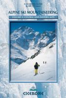
Cover

The European Alps offer some of the finest and most accessible ski mountaineering in the world. A combination of magnificent and varied terrain, an enviable snow record, excellent public transport, unrivalled hut system and a long ski season make them a focus for mountaineering and skiers throughout the world.

This guidebook includes some of the finest ski tours of the central and eastern Alps - hut-to-hut trails that explore the Bernese, Urner, Albula and Bernina Alps of Switzerland, as well as classic tours through the Silvretta, Otztal, Stubai and Ortler regions of Austria and Italy. None of the routes is extreme, although the conditions can be, and it’s for that reason that mountaineering judgement and sound decisions are all important.

The 11 tours in this guidebook cover a significant part of the Northern as well as the Central and Eastern Alps. They range across Alpine Switzerland from its north-west corner to its south-east tip, from Vaud to Graubunden, before sliding east, following the vast arc of the Alps into the Austrian Tyrol and South Tyrol of north Italy.

All the tours described in this guidebook are in areas that bristle with 3000m peaks, glaciers and extensive permanent snowfields. The Central and Eastern Alps also have an enviable snow record, and in many instances can offer ski touring when other areas are waiting for better snow cover to fill crevasses and make travel on dangerous glaciers possible.

The selection in this guidebook covers tours in the most important Alpine regions. They are also varied in length and difficulty, although most fit within a full week’s touring. Of course, if poor weather or conditions prevail they can take a lot longer. The routes also include a mix of circular tours, which are convenient for those wishing to leave car or equipment in one place, and linear routes that journey hut to hut or even from country to country.

The routes described are all Alpine - they require both skiing and mountaineering skills. While technical climbing ability of a high standard is not essential, the skills required to operate on steep slopes and glacial terrain, where cramponing, ropework and crevasse rescue may be necessary, are essential for safety, as are navigational skills. It goes without saying that avalanche awareness skills and knowledge are vitally important for everyone who intends to ski mountaineer.

Kartenausschnitt

Kartenbeispiel

Alpine Ski Mountaineering Volume 2: Central and Eastern Alps Alps - cross border routes (englisch) - Cicerone
EAN / ISBN: 9781852843748
Preis: EUR 22.90

Dieser Titel ist momentan nicht lieferbar.
Produkt EUR Anzahl Bestellen
Alpine Ski Mountaineering Volume 2: Central and Eastern Alps Alps - cross border routes (englisch) - Cicerone 22.90
Versandkostenfrei in Deutschland ab 30,- Bestellwert

incl. MwSt.

Stichworte, die bei der Suche nützlich sein könnten:
Zentralalpen - Ötztaler Alpen - Zentral-Alpen - Silvretta - Ostalpen - Ortler-Alpen - Stubaier Alpen - Ost-Alpen - Schweiz Wanderführer - Schweiz Kletterführer - Schweiz Fahrradführer - Schweiz Reiseführer - Alpen Italien Klettern - Italienische Alpen - Italienische Alpen Wanderführer - Alpen Italien - Italienische Alpenführer - Italienische Alpen Kletterführer - Italienische Alpen Klettern - Italienische Alpen Bergsteigen - Italienische Alpen Wandern - Italienische Alpen Reiseführer - Italienische Alpen Wanderführer - Österreich - Österreich Wanderführer - Österreich Skiführer - Österreich Wintersportführer - Slowenien Wanderführer - Slowenien Kletterführer - Slowenien Reiseführer - Italien Wintersport - Italien Wintersportführer - Italien Skiführer - Südtirol Wintersport - Südtirol Winterwandern - Südtirol Langlaufkarten - Italien Wintersportkarten - Italien Skikarten - Italien Winterwanderkarten - Cicerone - Cicerone Radwanderführer - Cicerone Wanderführer - Großbritannien Radwanderführer - Großbritannien Wanderführer - Cicerone Großbritannien

Zuletzt angesehene Artikel:

CoverAlpine Ski Mountaineering Volume 2: Central and Eastern Alps Alps - cross border routes (englisch) - Cicerone

CoverRuppiner Schweiz Topographische Wanderkarte mit Wanderwegen und Radwegen 1:50.000 - ProjektNord

CoverUruguay 1:770.000 / Stadtplan Montevideo 1:10.000 Landkarte - ITMB International Travel Reference Map (engl.)

Cover45 HAUTE SAVOIE 1:100.000 Topographische Landeskarte der Schweiz - swisstopo

CoverUSA Nordwesten Reisehandbuch - Iwanowski´s Reisebuchverlag

CoverE-Bike-Region Stuttgart ADFC-Regionalkarte 1:75.000 BVA Bielefelder Verla

CoverTennessee Straßenkarte 1:1.1 Mio. (wasserfest, reißfest) GuideMap National Geographic - USA

CoverFrankreich 1:875.000 Straßenkarte Borch laminiert
France

Noch kein Cover vorhanden3646-SW Topographische Karte 1:10.000 - Landesvermessungsamt Brandenburg

Noch kein Cover vorhanden54-a Topographische Landkarte Georgien 1:50.000 Geoland Maps Georgien

Cover354 Colonsay & Oronsay - Wanderkarte Großbritannien 1:25.000 EXPLORER MAP - Active Map LAMINIERT - Ordnance Survey

Noch kein Cover vorhanden2147ET FOIX / TARASCON-SUR-ARIEGE Topographische Wanderkarte Frankreich 1:25.000 TOP 25 IGN - (GPS)

CoverCityTrip Alicante Reiseführer mit Stadtplan und kostenloser Web-App - von Henkel, Jan - Reise Know-How

Noch kein Cover vorhandenL8510 Weil am Rhein Topographische Landkarte 1:50.000 - Landesvermessungsamt Baden-Württemberg

CoverAbuja The premier guidebook for Business Globetrotters (englisch)
AbujaCity Guide eBiz Guides

CoverRomantisches Franken ADFC-Regionalkarte 1:60.000 BVA Bielefelder Verlag

CoverGreater Vancouver & Fraser Valley Atlas
Greater Vancouver GMJ Map Book GM Johnson

CoverC6306 Idar-Oberstein Topographische Landkarte 1:100.000 - Landesvermessungsamt Rheinland-Pfalz

CoverMerced & Tuolomne Rivers - Stanislaus California 1:63.360 (Blatt: 808) Landkarte Trails Illustrated Map National Geographic - USA

CoverSaarbrücken 1990 1:3.500/1:17.000 (Blatt 255) Bildstadtplan Bollmann-Bildkarten-Verlag
