Willkommen bei MapFox
Wurde Ihre Bestellung bestätigt? Wenn nicht - gab es evtl. ein SERVER-Problem! Bitte kontaktieren Sie uns! +++ Buchhändler-Anfragen erwünscht +++
Warenkorb
Artikel: 0 - € 0.00
Zur Kasse
Impressum Kontakt Versandkosten AGB
Beacons Way XT40 - Long Distance Route - Wanderkarte 1:40.000 HARVEY MAPS
<< Großbritannien: Wanderkarten, Radwanderkarten und MTB-Karten
<< Harvey Maps
 
Cover

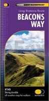
The Beacons Way traverses across the full length of Bannau Brycheiniog National Park. Established in 2005, the Way is a challenging route that has been designed to showcase the best the park has to offer, taking in deep valleys, expansive moorland, and the highest mountains in Southern Britain. A challenging trail, navigation skills are required on the more open sections where waymarking is limited.

Beacons Way XT40 - Long Distance Route - Wanderkarte 1:40.000 HARVEY MAPS
EAN / ISBN: 9781851377251
Preis: EUR 26.90

Bestellartikel: versandfertig in ca. 3-7 Tagen. Dieser Artikel wird speziell für Sie bestellt. Keine Rücknahme!
Produkt EUR Anzahl Bestellen
Beacons Way XT40 - Long Distance Route - Wanderkarte 1:40.000 HARVEY MAPS 26.90
Versandkostenfrei in Deutschland ab 30,- Bestellwert

incl. MwSt.

Stichworte, die bei der Suche nützlich sein könnten:
Brecon Beacons (Wales) Hiking Map - Wales - Brecon Beacons East (Wales) Wanderkarte - Großbritannien Wanderkarten - Großbritannien Fahrradkarten - Großbritannien Mountainbike-Karten - Harvey maps - Superwalker - Schottland Wanderkarten - Großbritannien Wanderkarten - Harvay - Harway Maps - Britsh Mountain Maps - BMC - Ultramaps - XT40 - XT25 - Great Britain walking maps - UK hiking maps - Scotland hiking maps - Harveymaps - UK Walking maps - Great Britain walking maps

Zuletzt angesehene Artikel:

CoverBeacons Way XT40 - Long Distance Route - Wanderkarte 1:40.000 HARVEY MAPS

CoverExmoor - 15 Short Walks Wanderführer - Cicerone (englisch)

CoverMadrid 1:10.000 Stadtplan Borch laminiert

CoverPyrenean Haute Route - A high-level trail through the Pyrenees Wanderführer - Cicerone (englisch)

Noch kein Cover vorhanden068 S Rena SØR 1:50.000 - Amtliche Topographische Landkarte Norwegen - Startens Kartverk

CoverMonte Morello 1:25.000 (MOR) - Wanderkarte Italien - D.R.E.A.M. Italia