Willkommen bei MapFox
Wurde Ihre Bestellung bestätigt? Wenn nicht - gab es evtl. ein SERVER-Problem! Bitte kontaktieren Sie uns! +++ Buchhändler-Anfragen erwünscht +++
Warenkorb
Artikel: 0 - € 0.00
Zur Kasse
Impressum Kontakt Versandkosten AGB
Forest of Bowland XT25 - Hiking Map Wanderkarte 1:25.000 HARVEY MAPS
<< Großbritannien: Wanderkarten, Radwanderkarten und MTB-Karten
<< Harvey Maps
 
Cover

More than a map - an essential piece of equipment.
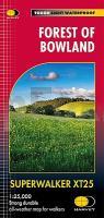
This new generation HARVEY Superwalker is designed to be the most practical tool for navigation outdoors.

- Ideal map for exploring the Forest of Bowland National Landscape
- Covers Settle, Gisburn Forest and the Trough of Bowland
- Extended coverage to include Pendle Hill
- The Superwalker XT25 is based on original HARVEY mapping with all the detail a walker would expect on a map at 1:25,000 scale
- Printed on strong, durable and 100% waterproof paper
- Includes Rights of Way
- Uncluttered by information irrelevant to the walker and less than half the weight of a laminated map
- Opens directly to either side of the sheet
- Shows pubs and cafes for the end of the day

Experience the satisfaction of fine navigation with the Superwalker XT25, printed on strong, durable and 100% waterproof paper - whatever the weather!

Forest of Bowland XT25 - Hiking Map Wanderkarte 1:25.000 HARVEY MAPS
EAN / ISBN: 9781851377206
Preis: EUR 26.90

Bestellartikel: versandfertig in ca. 3-7 Tagen. Dieser Artikel wird speziell für Sie bestellt. Keine Rücknahme!
Produkt EUR Anzahl Bestellen
Forest of Bowland XT25 - Hiking Map Wanderkarte 1:25.000 HARVEY MAPS 26.90
Versandkostenfrei in Deutschland ab 30,- Bestellwert

incl. MwSt.

Stichworte, die bei der Suche nützlich sein könnten:
St. Cuthberts Way Hiking Map - St. Cuthberts Way (Großbritannien) Wanderkarte - Saint Cuthberts Way - Großbritannien Wanderkarten - Großbritannien Fahrradkarten - Großbritannien Mountainbike-Karten - Harvey maps - Superwalker - Schottland Wanderkarten - Großbritannien Wanderkarten - Harvay - Harway Maps - Britsh Mountain Maps - BMC - Ultramaps - XT40 - XT25 - Great Britain walking maps - UK hiking maps - Scotland hiking maps - Harveymaps - UK Walking maps - Great Britain walking maps

Zuletzt angesehene Artikel:

CoverForest of Bowland XT25 - Hiking Map Wanderkarte 1:25.000 HARVEY MAPS

Cover134 Bischofsmais - Deggendorf 1:35.000 Wanderkarte Fritsch Landkarten-Verlag

Noch kein Cover vorhandenCC 2342 Stralsund Bodenübersichtskarte 1:200.000 - Bundesanstalt für Geowissenschaften und Rohstoffe (BGR)

CoverLuxembourg Province - 16 randonnées en boucle (Tome 2) Topo-Guide du Sentier de Grande Randonnée - Belgien (französisch) GRSentiers - Grote Routepaden

Cover15 Short Walks in Arnside and Silverdale Wanderführer North West England - Cicerone Großbritannien (englisch)

Cover15 Finale Ligure - Alassio - Savona - Topographische Wanderkarte 1:50.000 - IGC Italien

Cover105 Kea (Tzia) 1:25.000 Landkarte Griechische Inseln - Road Editions - Griechenland

CoverGöttingen - Oberes Leinetal ADFC-Regionalkarte 1:75.000 BVA Bielefelder Verlag

CoverDuMont Reise-Taschenbuch Reiseführer Dänemark, Nordseeküste DuMont Reiseverlag

CoverWellin Chanly - Halma - Lomprez - Sohier - Wanderkarte NGI 1:15.000 Belgien mit 10 Wanderungen

CoverTrossachs North / Loch Lyon / Crianlarich XT25 - Wanderkarte 1:25.000 Harvey Maps Großbritannien

CoverEuropa Postleitzahlen 1:3.7 Mio. Wandkarte 96 x 112 cm metallbestäbt in Rolle freytag & berndt

CoverAlpilles Camargue - Etangs & colines à pied Wanderführer - (französisch) Chamina - Frankreich

Cover18/7-8 MAASEIK - OPHOVEN NGI 1:25.000 Topographische Landkarte Belgien

CoverRheinsberger Seengebiet - Ruppiner Land 1:50.000 (Blatt 743) - Wanderkarte mit Broschüre KOMPASS

CoverHaute Route Von Chamonix nach Zermatt. Hochtourenroute - Wanderroute. Mit GPS-Daten - Rother Wanderführer von Marianne Bauer und Michael Waeber - Bergverlag Rother

CoverKrakau Altstadtplan 1:5.000
Krakow Stare Miasto Wydawnictwo Gauss

CoverC7518 Stuttgart Süd Topographische Landkarte 1:100.000 - Landesvermessungsamt Baden-Württemberg

CoverVatikanstadt Stadtplan 1:2.250 Straßenkarte
Vatican City GiziMap

CoverL5330 Suhl Topographische Karte Thüringen 1:50.000 Landesvermessungsamt Thüringen