Willkommen bei MapFox
Wurde Ihre Bestellung bestätigt? Wenn nicht - gab es evtl. ein SERVER-Problem! Bitte kontaktieren Sie uns! +++ Buchhändler-Anfragen erwünscht +++
Warenkorb
Artikel: 0 - € 0.00
Zur Kasse
Impressum Kontakt Versandkosten AGB
Mourne Mountains - Wanderkarte 1:25.000 Superwalker waterproof - HARVEY MAPS
<< Großbritannien: Wanderkarten, Radwanderkarten und MTB-Karten
<< Harvey Maps
 
Cover

The Mournes, a granite mountain range in County Down, includes the highest mountains in Northern Ireland. The highest is Slieve Donard at 850 metres.

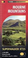
Detailed map for hillwalkers of the Mountains of Mourne at 1:25,000 scale.

The Mournes is an Area of Outstanding Natural Beauty and has been proposed as the first national park in Northern Ireland. The area is partly owned by the National Trust and sees a large number of visitors every year.

The Mourne Wall is among the more famous features in the Mournes. It is a 35km (22mls) drystone wall that crosses fifteen summits, constructed in 1904 and completed in 1922 to define the boundaries of land purchased by the Belfast Water Commissioners in the late 1800s.

Includes The Mourne Way Long Distance Footpath.

Kartenausschnitt

Kartenbeispiel

Mourne Mountains - Wanderkarte 1:25.000 Superwalker waterproof - HARVEY MAPS
EAN / ISBN: 9781851376124
Preis: EUR 23.90

Bestellartikel: versandfertig in ca. 3-7 Tagen. Dieser Artikel wird speziell für Sie bestellt. Keine Rücknahme!
Produkt EUR Anzahl Bestellen
Mourne Mountains - Wanderkarte 1:25.000 Superwalker waterproof - HARVEY MAPS 23.90
Versandkostenfrei in Deutschland ab 30,- Bestellwert

incl. MwSt.

Stichworte, die bei der Suche nützlich sein könnten:
Mourne Mountains Hiking Map - Mourne Mountains Wanderkarte - Großbritannien Mourne Mountains - Großbritannien Wanderkarten - Großbritannien Fahrradkarten - Großbritannien Mountainbike-Karten - Harvey maps - Superwalker - Schottland Wanderkarten - Großbritannien Wanderkarten - Harvay - Harway Maps - Britsh Mountain Maps - BMC - Ultramaps - XT40 - XT25 - Great Britain walking maps - UK hiking maps - Scotland hiking maps - Harveymaps - UK Walking maps - Great Britain walking maps

Zuletzt angesehene Artikel:

CoverMourne Mountains - Wanderkarte 1:25.000 Superwalker waterproof - HARVEY MAPS

CoverDuMont Reise-Taschenbuch Malta, Gozo & Comino von Latzke, Hans E.

Noch kein Cover vorhanden164.33 Amtliche topographische Karte 1:25.000 Polen

Noch kein Cover vorhanden183.21 Amtliche topographische Karte 1:25.000 Polen

CoverAbruzzen - Molise Straßenkarte Local 1:200.000 (Blatt 361) Michelin Italien

Noch kein Cover vorhanden261.41 Amtliche topographische Karte 1:25.000 Polen

CoverIran Reiseführer Das einstige Persien zwischen Tradition und Moderne - von Peter Kerber - Trescher Verlag

Noch kein Cover vorhanden3346-SW Topographische Karte 1:10.000 - Landesvermessungsamt Brandenburg

Noch kein Cover vorhanden442.31 Amtliche topographische Karte 1:25.000 Polen

Noch kein Cover vorhanden041 S Hardangervidda SØR 1:50.000 - Amtliche Topographische Landkarte Norwegen - Startens Kartverk

Noch kein Cover vorhanden112.12 Amtliche topographische Karte 1:25.000 Polen

Noch kein Cover vorhanden3444-SW Topographische Karte 1:10.000 - Landesvermessungsamt Brandenburg

CoverTranssib-Handbuch Unterwegs mit der Transsibirischen Eisenbahn - Engberding, Hans - Thöns, Bodo Trescher Verlag

Noch kein Cover vorhanden253.1 Amtliche topographische Karte 1:50.000 Polen

CoverMARCO POLO Cityplan New York 1 : 15 000 MairDuMont

CoverSant Llorenc del Munt i l`Obac E25 1:25.000 Wanderkarte Spanien - ALPINA

Noch kein Cover vorhanden244.32 Amtliche topographische Karte 1:25.000 Polen

Noch kein Cover vorhanden512.31 Amtliche topographische Karte 1:25.000 Polen

CoverMittelmeer - Kreuzfahrten 1:2.2 Mio. - ITMB International Travel Reference Map
Mediterranean Cruising

CoverAsien 1:9 Mio. Kontinentkarte - Freytag-Berndt und ARTARIA