Willkommen bei MapFox
Wurde Ihre Bestellung bestätigt? Wenn nicht - gab es evtl. ein SERVER-Problem! Bitte kontaktieren Sie uns! +++ Buchhändler-Anfragen erwünscht +++
Warenkorb
Artikel: 0 - € 0.00
Zur Kasse
Impressum Kontakt Versandkosten AGB
Castrop-Rauxel Nord 1944 1:19.000 (Blatt 12) Alte Stadtpläne des Ruhrgebiets
Old maps of the Ruhr Alan Godfrey Maps
<< Deutschland: Historische Karten und Stadtpläne (im Bereich der heutigen Bundesrepublik)
<< Alan Godfrey - Historische Landkarten und Stadtpläne
 
Cover

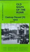
Series of maps taken from the British War Office GSGS.4525 maps published in 1945. Introduction in English by Alan Godfrey, with a summary in German. At a scale of approx 1:19,000 the map is especially good at showing industry, collieries and transport at the time.

Castrop-Rauxel, including Henrichenburg, Pöppinghausen, Ickern, and coverage extends eastward to Mengede and NE to Waltrop (in the top right corner).

Features include Dortmund-Ems Canal, with the Henrichenburg Ship Lift, Emscher Canal, Rutghers Estate, Suderwich, Brüninghausen, Mengeder, Bladenhorst Manor House, Adolf von Hansemann mine, Ickern mine.

Einführung in englischer Sprache von Alan Godfrey, mit einer Zusammenfassung in deutscher Sprache. Mit Bergwerken und Eisenbahnen.

Kartenausschnitt

Kartenbeispiel

Castrop-Rauxel Nord 1944 1:19.000 (Blatt 12) Alte Stadtpläne des Ruhrgebiets
Old maps of the Ruhr Alan Godfrey Maps
EAN / ISBN: 9781847845252
Preis: EUR 9.95

sofort versandfertig Dieser Artikel ist im Normalfall sofort lieferbar.
Produkt EUR Anzahl Bestellen
Castrop-Rauxel Nord 1944 1:19.000 (Blatt 12) Alte Stadtpläne des Ruhrgebiets
Old maps of the Ruhr Alan Godfrey Maps
9.95
Versandkostenfrei in Deutschland ab 30,- Bestellwert

incl. MwSt.

Stichworte, die bei der Suche nützlich sein könnten:
Castrop-Rauxel - Historische Militärkarte Ruhrgebiet - Militärhistorische Landkarte Ruhrgebiet - Deutsches Reich - Historische Stadtpläne - Historische Landkarten Deutschland - Historische Stadtpläne Deutschland - Kriegshistorische Landkarten - 2. Weltkrieg Landkarten - Godfrey

Zuletzt angesehene Artikel:

CoverCastrop-Rauxel Nord 1944 1:19.000 (Blatt 12) Alte Stadtpläne des Ruhrgebiets
Old maps of the Ruhr Alan Godfrey Maps

Noch kein Cover vorhanden463.13 Amtliche topographische Karte 1:25.000 Polen

CoverNorth York Moors NP pocket map 1:115.000 Pocket map - National Parks UK and Collins Maps

Noch kein Cover vorhanden412.33 Amtliche topographische Karte 1:25.000 Polen

CoverOL3 Meon Valley - Portsmouth - Gosport & Fareham - Wanderkarte Großbritannien 1:25.000 EXPLORER MAP - Ordnance Survey

CoverFernwanderwege Schwarzwald - 41 Etappen - auf dem Westweg, Mittelweg und Ostweg von Pforzheim an die Schweizer Grenze - Rother Wanderführer - Bergverlag Rother

Noch kein Cover vorhandenBZ10 Topographische Landkarte Neuseeland 1:50.000 Land Information New Zealand

CoverInsel Juist 1:20.000 (Blatt 728) - Wanderkarte mit Broschüre KOMPASS

Cover2412 Wittmund Amtliche topographische Karte 1:25.000 Landesvermessungsamt Niedersachsen

CoverCursa La Marrana - Ulldeter - Coma de l`Orri - Coma de Vaca Wanderkarte 1:20.000 - Editorial Piolet - Spanien

CoverM412 Valkeakoski Topographische Karte 1:50.000 EUREF-FIN (Maastokarttat) Maanmittauslaitos / Lantmäteriverket Finnland - ProjektNord

CoverMallorca Ost 1:60.000 (Blatt RK-MALLO02) - Inca - Artà - Manacor - Llucmajor - Cala d`Or bikeline-Radkarte - Spanien Esterbauer

CoverL23 Topographische Karte 1:100.000 EUREF-FIN Maanmittauslaitos / Lantmäteriverket Finnland - ProjektNord

CoverADAC Länderkarte Niederlande 1:300.000 - von - MAIRDUMONT

CoverBike Guide Allgäuer Alpen 40 Mountainbike-Touren zwischen Lindau und Füssen. Mit GPS-Tracks - von Baur, StephanBaur, Sebastian - Bergverlag Rother

Cover09E DE COCKSDORP Topographische Karte der Niederlande 1:25.000 (Plotausgabe)
09E DE COCKSDORP Topografische Kaart van Nederland Kadaster - ProjektNord

Noch kein Cover vorhanden273.3 Amtliche topographische Karte 1:50.000 Polen

CoverÄmter Stolpen, Radeberg und Lausitz, 1754 (Nr. 4) - historische Landkarte - Nachdruck KURFÜRSTENTUM SACHSEN - MEISSNISCHER KREIS. - von Peter (der Jüngere) Schenk - Plano gerollt - Verlag Rockstuhl

CoverSyrakus Stadtplan 1:8.000
Siracusa - Pianta della Citta L.A.C. GlobalMap Italien

CoverWandern mit Hund - Schwarzwald 42 Touren. Mit GPS-Daten - von Martin Kuhnle - Bergverlag Rother