Willkommen bei MapFox
Wurde Ihre Bestellung bestätigt? Wenn nicht - gab es evtl. ein SERVER-Problem! Bitte kontaktieren Sie uns! +++ Buchhändler-Anfragen erwünscht +++
Warenkorb
Artikel: 0 - € 0.00
Zur Kasse
Impressum Kontakt Versandkosten AGB
Castrop-Rauxel Süd 1944 1:19.000 (Blatt 13) Alte Stadtpläne des Ruhrgebiets
Old maps of the Ruhr Alan Godfrey Maps
<< Deutschland: Historische Karten und Stadtpläne (im Bereich der heutigen Bundesrepublik)
<< Alan Godfrey - Historische Landkarten und Stadtpläne
 
Cover

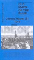
Series of maps taken from the British War Office GSGS.4525 maps published in 1945. Introduction in English by Alan Godfrey, with a summary in German. At a scale of approx 1:19,000 the map is especially good at showing industry, collieries and transport at the time.

Einführung in englischer Sprache von Alan Godfrey, mit einer Zusammenfassung in deutscher Sprache.

Die Landkarte deckt den südlichen Teil von Castrop-Rauxel und den westlichen Teil von Dortmund ab.

Mit Castrop Zentrum, Goldschieding Haus, Erin Mine, Zollern Mine, Bövinghausen, Lütgendortmund, Marten, Holte, Harpenerweg, Merklinde, Kirchlinde, Bodelschwingh, Schellenberg, Hiltrop Dorf, Sodingen, Lothringen Mine, Börnig, Ober Castrop etc. Mit Bergwerken und Eisenbahnen.

Kartenausschnitt

Kartenbeispiel

Castrop-Rauxel Süd 1944 1:19.000 (Blatt 13) Alte Stadtpläne des Ruhrgebiets
Old maps of the Ruhr Alan Godfrey Maps
EAN / ISBN: 9781847844330
Preis: EUR 9.95

Bestellartikel: versandfertig in ca. 3-7 Tagen. Dieser Artikel wird speziell für Sie bestellt. Keine Rücknahme!
Produkt EUR Anzahl Bestellen
Castrop-Rauxel Süd 1944 1:19.000 (Blatt 13) Alte Stadtpläne des Ruhrgebiets
Old maps of the Ruhr Alan Godfrey Maps
9.95
Versandkostenfrei in Deutschland ab 30,- Bestellwert

incl. MwSt.

Stichworte, die bei der Suche nützlich sein könnten:
Militärhistorische Landkarte Ruhrgebiet - Historische Militärkarte Ruhrgebiet - Castrop-Rauxel - Dortmund - Deutsches Reich - Historische Stadtpläne - Historische Landkarten Deutschland - Historische Stadtpläne Deutschland - Kriegshistorische Landkarten - 2. Weltkrieg Landkarten - Godfrey

Zuletzt angesehene Artikel:

CoverCastrop-Rauxel Süd 1944 1:19.000 (Blatt 13) Alte Stadtpläne des Ruhrgebiets
Old maps of the Ruhr Alan Godfrey Maps

CoverElsass - Vogesen 1:200.000 Straßenkarte Kümmerly + Frey

CoverCosenza Stadtplan 1:6.000
Cosenza - Pianta della Citta L.A.C. GlobalMap Italien

CoverChile - Argentinien Straßenkarte 1:2 Mio. (Blatt 788) Michelin

CoverVia Regia - Pilgerweg von Görlitz nach Vacha - von Thorsten Hoyer - Conrad-Stein-Verlag

CoverToskana 1:200.000 Straßenkarte Italien (Blatt 358)
Toscana Michelin Local

CoverCalifornia - Nevada - Straßenkarte USA Road Guide 1:1Mio (Blatt 5) - Hallwag

Noch kein Cover vorhanden3616OT Lac de Pierre-Percée - LE DONON Topographische Wanderkarte Frankreich 1:25.000 TOP 25 IGN - (GPS)

CoverLot - Aveyron - Vallée du Tarn - Reiseführer französisch LeGuideVert - Michelin (Originalausgabe)

CoverLandeshaupstadt Kiel 1:25.000 *POSTER* Format 70 x 100 cm - ProjektNord

CoverIl Biellese Sud-Occidentale Foglio 3 1:25.000 - Wanderkarte - Ingenia Editori - Italien

CoverDenk doch - was du willst Die Freiheit der Gedanken - von Thorsten Havener - Wunderlich

CoverMailand Stadtplan 1:12.500
Milano Milaan freytag & berndt

CoverA-Z Place Names of South Africa - MapStudio Südafrika

CoverAlta Valle Brembana (Foglio 2) 1:25.000 Ingenia Editori - Wanderkarte - Italien

CoverBonn - Siebengebirge - Ahrtal (Blatt 822) Wanderkarten-Set mit Radrouten. GPS-genau. 1:35.000 - KOMPASS-Karten

CoverBahnradweg Hessen 1:50.000 bikeline Radwanderführer - Esterbauer

CoverPolar Exploration A Practical Handbook for North and South Pole Expeditions - von Dixie Dansercoer - Cicerone

Cover1Q84. Buch 3 Roman von Haruki Murakami - DuMont Buchverlag

CoverSlowakei 1:500.000
SLOVAKIA - Slovensko - Internationale Landkarte - Cartographia