Willkommen bei MapFox
Wurde Ihre Bestellung bestätigt? Wenn nicht - gab es evtl. ein SERVER-Problem! Bitte kontaktieren Sie uns! +++ Buchhändler-Anfragen erwünscht +++
Warenkorb
Artikel: 0 - € 0.00
Zur Kasse
Impressum Kontakt Versandkosten AGB
Azores Travel Guide Reiseführer (englisch) Bradt Publications
<< Portugal: Madeira, Azoren
<< Bradt Publications
 
Cover

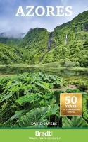
Lying between New York and Lisbon and sometimes referred to as Europe`s best kept secret, the Azores are verdant, tranquil, diverse, exquisitely beautiful and always welcoming. These nine green islands are the embodiment of old-world charm and include an elegant capital, remote villages, glittering blue coastlines and spectacular volcanic landscapes.

Bradt`s Azores is the only publication in English that not only provides details of travel and activities, but also gives in-depth background information about the archipelago`s discovery, settlement and subsequent social history. David Sayers outlines how the archipelago erupted from beneath the ocean some five million years ago. Revised throughout, this new edition also includes in-depth sections on whaling, fishing and agriculture, climate, and geology.

There is now a wide choice of accommodation, from 4-star hotels to small family-run affairs, simple pensions, rented cottages and B&Bs - all detailed in the guide. Tourism services have expanded with greater numbers of marked walking trails, improved opportunities for diving, whale watching and adventurous activities such as sea kayaking and jeep safaris, and excellent new museums.

The islands remain an outstanding destination for walkers and lovers of nature and the simple life. Tourism has not been allowed to spoil the archipelago and the islands retain much of their traditional charm - they are not a beach destination, and there is little nightlife or commercial entertainment. With this guide visitors can discover the best walks, tour Europe`s westernmost coast - the island of Flores - visit Europe`s only tea plantations or step into the hot springs and gurgling mud pools of Furnas. Brimming with practical information this new edition of The Azores is the perfect guide to these garden-like islands.

Kartenausschnitt

Kartenbeispiel

Azores Travel Guide Reiseführer (englisch) Bradt Publications
EAN / ISBN: 9781804691731
Preis: EUR 26.95

Bestellartikel: versandfertig in ca. 3-7 Tagen. Dieser Artikel wird speziell für Sie bestellt. Keine Rücknahme!
Produkt EUR Anzahl Bestellen
Azores Travel Guide Reiseführer (englisch) Bradt Publications 26.95
Versandkostenfrei in Deutschland ab 30,- Bestellwert

incl. MwSt.

Stichworte, die bei der Suche nützlich sein könnten:
Azoren - Azores - Bradt Publications - Bradt Reiseführer - Madeira - Azoren

Zuletzt angesehene Artikel:

CoverAzores Travel Guide Reiseführer (englisch) Bradt Publications

CoverMartti - Vintilänkaira - Lattuna 1:50 000 Topographische Wanderkarte - Outdoor map - Genimap / Karttakeskus - Finnland
The boreholes between Kairijoki, Kemihaara and Värriöjoki

CoverSistan-va-Baluchestan Province Road Map (Persian & English) 1:800.000 Landkarte Englisch und Persisch (471)
نقشه راهنماي استان سيستان و بلوچستان Gitashenasi - Iran

Noch kein Cover vorhanden2937-SW Topographische Karte 1:10.000 - Landesvermessungsamt Brandenburg

CoverQom Province (Blatt 509) 1:245.000 Landkarte Englisch und Persisch
نقش استان قم Gitashenasi - Iran

CoverCC 7102 Saarbrücken Topographische Übersichtskarte 1:200.000 - Bundesamt für Kartografie und Geodäsie und Landesvermessungsämter - ProjektNord

CoverL4134 Vantaa Topographische Karte 1:25.000 EUREF (Peruskartta) Maanmittauslaitos / Lantmäteriverket Finnland - ProjektNord

CoverN5124 Joroinen Topographische Karte 1:25.000 EUREF (Peruskartta) Maanmittauslaitos / Lantmäteriverket Finnland - ProjektNord

Noch kein Cover vorhanden1195 Kreuzingen Topographische Karte 1:25.000 Messtischblatt des Deutschen Reiches - Preußische Landesaufnahme / Reichsamt für Landesaufnahme - Faksimile ProjektNord

CoverOrlicko - Trebovsko (Blatt 69) Topographische Wanderkarte 1:25.000 Geodezie On Line - Tschechien

Cover389 Forfar - Brechin & Edzell - Wanderkarte Großbritannien 1:25.000 EXPLORER MAP - Ordnance Survey

Cover117 Monte Baldo 1:25.000 Wander- und Mountainbikekarte GPS (Extra stabil und wasserfest) - 4land

CoverHortobágyi Nemzeti Park Wanderkarte 1:90.000 Ungarn Paulus - Ungarn

CoverBaedeker Reiseführer Burgund von Dr. Madeleine Reincke u. Susanne Feess - MAIRDUMONT

CoverAlgerisch-Arabisch - Wort für Wort Kauderwelsch-Sprachführer (Band 126) Reise-Know-How Verlag

CoverCentral Coast Suburban Streets (Blatt 289) Landkarte 1:25.000 - touring map - New South Wales - Australien UBD Gregory`s Universal Publishers - Australien

CoverSchlesische Beskiden 1:50.000 Touristische Landkarte
BESKID SLASKIE - mapa turystyczna / tourist map / carte touristique Wydawnictwo Pietka - Polen

Cover9 Altmühltal - Landkarte 1:100.000 (ATK100) - Ingolstadt - Kelheim - Neumarkt i.d.Opf. - Amtliche topographische Karte Bayern - Landesvermessungsamt Bayern

CoverWestliche Balkanregion (1:725.000) 1:725.000 World Mapping Project. Reise Know-How Verlag

Cover069 Isle of Arran - Wanderkarte Großbritannien 1:50.000 Active Laminiert LANDRANGER MAP - Ordnance Survey