Willkommen bei MapFox
Wurde Ihre Bestellung bestätigt? Wenn nicht - gab es evtl. ein SERVER-Problem! Bitte kontaktieren Sie uns! +++ Buchhändler-Anfragen erwünscht +++
Warenkorb
Artikel: 0 - € 0.00
Zur Kasse
Widerruf Impressum Kontakt Versandkosten AGB
Walking the Prosecco Hills Italien - Cicerone
<< Italien: Wanderführer und Reiseführer
<< Cicerone
 
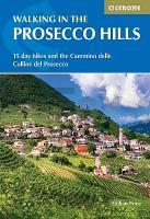
Cover

Discover the vineyard-covered hills of northern Italy with this guide to walking in the Prosecco Hills, a UNESCO-listed landscape between Conegliano and Valdobbiadene in the Veneto region. Terraced vineyards, wooded slopes and historic villages create a distinctive patchwork of scenery, with quiet paths linking churches, castles and wine-producing communities in one of Italy’s most celebrated rural landscapes.

The routes are suitable for walkers of all abilities, with a mix of short vineyard walks and a longer multi-day trail through the region. Day walks range from gentle strolls to rewarding hill walks, while the 4-day Cammino delle Colline del Prosecco links valleys and hilltop villages between Vidor and Vittorio Veneto. The guidebook is ideal for travellers who want to combine scenic walking with local culture, food and wine.

15 varied day walks ranging from 2-13km (1-8 miles), plus the 4-day Cammino delle Colline del Prosecco covering 51km (32 miles) across the heart of the region

Routes explore the UNESCO-listed Prosecco Hills north of Venice, following paths through terraced vineyards, wooded hillsides and quiet rural lanes

Walks connect historic villages and wine towns including Valdobbiadene, Pieve di Soligo, Follina, Conegliano and Vittorio Veneto Clear step-by-step route descriptions with 1:50,000 map extracts for every walk to make navigation straightforward

GPX files available to download, allowing you to follow each route easily using a GPS device or smartphone navigation app

Detailed practical information on planning, facilities, public transport, accommodation and local wineries, helping you combine walking with food and wine experiences

From peaceful vineyard paths to historic hilltop villages, these routes offer a relaxed way to experience the landscapes, traditions and flavours of Italy’s Prosecco country. This guidebook provides everything you need to plan memorable walks in one of northern Italy’s most distinctive regions.

Walking the Prosecco Hills Italien - Cicerone
EAN / ISBN: 9781786312617
Preis: EUR 24.90

Bestellartikel: versandfertig in ca. 1-3 Wochen. Dieser Artikel wird speziell für Sie bestellt. Keine Rücknahme!
Produkt EUR Anzahl Bestellen
Walking the Prosecco Hills Italien - Cicerone 24.90
Versandkostenfrei in Deutschland ab 30,- Bestellwert

incl. MwSt.

Stichworte, die bei der Suche nützlich sein könnten:
Italien Wanderführer - Italien Reiseführer - Cicerone - Cicerone Radwanderführer - Cicerone Wanderführer - Großbritannien Radwanderführer - Großbritannien Wanderführer - Cicerone Großbritannien

Zuletzt angesehene Artikel:

CoverWalking the Prosecco Hills Italien - Cicerone

CoverWanderführer Mecklenburgisch-Brandenburgische Kleinseenplatte von Fuß, Hans-Jürgen - grünes herz

CoverFahner Höhe 1:25.000 Wanderkarte mr-kartographie - Manfred Müller - mr-kartographie - Verlag grünes herz

CoverWanderkarte Hilchenbach wandern ... direkt am Rothaarsteig! : Luftkurort Hilchenbach, Leben am Rothaarsteig - von Herausgeber: Tourismus- & Kneippverein Hilchenbach e.V. ; Kartographie: mr-kartographie, Ingenieurbüro und Verlag - grünes herz

CoverKartenatlas Romboleden 1:50.000 - Calazo Förlag - Norwegen
Friluftsatlas Romboleden

CoverDalmatinische Küste Süd 1:100.000 - Wanderkarte (Nr. 2903) Dubrovnik - Kotor - Ulcinj KOMPASS

Cover3133 Pretzier (SONDERDRUCK) Topographische Landkarte Sachsen-Anhalt 1:25.000 - Normalausgabe - ProjektNord (geplottete Ausgabe) - Grundlage amtliche Topographische Karte DTK25

CoverWanderkarte Hallenberg 1:25.000 Winterberg mit Hallenberg - von Winterberg Touristik und Wirtschaft GmbH, Winterberg Touristik und Wirtschaft (Herausgeber) - grünes herz

CoverWorld Explorer 1:37.213 M (laminiert) Reference Map - National Geographic - USA

CoverDendervallei zuid wandelnetwerk - Vlaamse Ardennen - Scheldeland Wanderkarte 1:50.000 - Belgien Wandelnetwerk Belgien

CoverRügen - Ein Wanderführer mit Hiddensee - von Fuß, Hans-Jürgen - grünes herz

Cover115J & 115K - Stevenson Ridge Topographische Landkarte 1:250.000 - Canada - Yukon Territory

CoverFahrradkarte Chemnitz 1:75.000 Von Döbeln zum Fichtelberg - wasserfest - reißfest- Grünes Herz

CoverJapan West & Kyushu 1:550.000 - Landkarte - ITMB International Travel Reference Map (engl.)
Japan West & Kyushu ITMB International Travel Maps (engl.)

CoverRaderlebnisPark Diemelsee & Bikewelt Willingen mr-kartographie, Ingenieurbüro und Verlag - Herausgeber: Gemeinde Diemelsee, Abt. Tourist-Information, Gemeinde Willingen (Upland), Abt. Tourist-Information - grünes herz

CoverRumänien - Moldawien 1:850.000 / 1:445.000 *** SCHNÄPPCHEN *** Landkarte - ITMB International Travel Maps (engl.)
Romania & Moldowa

CoverTussen Zwalm en Dender - wandelnetwerk - Vlaamse Ardennen - Scheldeland Wanderkarte 1:25.000 - Belgien Wandelnetwerk Belgien

CoverWanderkarte Drei Gleichen 1:15.000 Natur, Umwelt, Tourismus - von Hrsg.: MR-Kartographie, Gotha - grünes herz

CoverKom - Vrachanski Balkan 1:25.000 Topographische Wanderkarte - Bulgarien Iskartour Bulgarien

CoverRad- - Wander- und Gewässerkarte Bärwalder See 1:40.000 mit Spree-Radweg - grünes herz
