Willkommen bei MapFox
Wurde Ihre Bestellung bestätigt? Wenn nicht - gab es evtl. ein SERVER-Problem! Bitte kontaktieren Sie uns! +++ Buchhändler-Anfragen erwünscht +++
Warenkorb
Artikel: 0 - € 0.00
Zur Kasse
Widerruf Impressum Kontakt Versandkosten AGB
Isle of Wight 1:32.000 Wanderkarte - Discovery Walking Guides Ltd
<< Großbritannien: Wanderkarten, Radwanderkarten und MTB-Karten
<< Discovery Walking Guides Ltd.
 
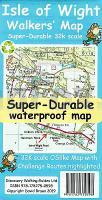
Cover

Confidently explore the Isle of Wight’s amazing variety of beautiful and varied scenery with Martin Simons’ 40 fully detailed walking routes suitable for a wide range of ages and fitness levels.
Each route’s itinerary includes: - walking route summary. - ratings for Effort, Time, Distance, Ascents/Descents, Refreshments and Vertigo risk. - access details for bus and car users. - fully detailed walk description, including frequent timings to aid navigation and check your progress. - GPS Waypoints at every key point on every route for pin-point navigational accuracy. - full colour OS map of each walk with the route and waypoints highlighted. - short walk and stroll alternatives.
Routes are linked to the Southern Vectis bus services with a ?bus return’ on the linear walking routes.
With Martin`s excellent walk descriptions you`ll know which routes are for you - and all of them are a true adventure

Packed into an island just 23 miles by 13 miles the Isle of Wight offers impressive hills, towering cliffs, river valleys, marshes, rich farmland, a variety of woodlands, prehistoric burial mounds, ancient churches, attractive villages, and a wealth of inns and pubs. Criss-crossed by over 500 miles of footpaths and bridleways, plus paths across access land, it also boasts nature reserves, forests, and the most spectacular beaches in the south of England.
You can discover all of these with Martin Simons’ Walk! the Isle of Wight.

Kartenausschnitt

Kartenbeispiel

Isle of Wight 1:32.000 Wanderkarte - Discovery Walking Guides Ltd
EAN / ISBN: 9781782750598
Preis: EUR 11.90

Bestellartikel: versandfertig in ca. 1-3 Wochen. Dieser Artikel wird speziell für Sie bestellt. Keine Rücknahme!
Produkt EUR Anzahl Bestellen
Isle of Wight 1:32.000 Wanderkarte - Discovery Walking Guides Ltd 11.90
Versandkostenfrei in Deutschland ab 30,- Bestellwert

incl. MwSt.

Stichworte, die bei der Suche nützlich sein könnten:
Isle of Wight - Isle of Wight Radwanderkarte - Isle of Wight Topographische Karte - Isle of Wight Wanderkarte - Isle of Wight Fahrradkarte - Discovery Walking Guides - Kanarische Inseln Wanderkarten - Madeira Wanderkarten - Großbritannien Wanderkarten - Großbritannien Fahrradkarten - Großbritannien Mountainbike-Karten

Zuletzt angesehene Artikel:

CoverIsle of Wight 1:32.000 Wanderkarte - Discovery Walking Guides Ltd

CoverHohe Mark Radroute Radeln zwischen Münsterland, Niederrhein und Ruhrgebiet, 1:50.000, 279 km, GPS-Tracks Download, LiveUpdate - Esterbauer

CoverKiew Stadtplan-Atlas 1:22.000 C6-Format
Kyiv - Atlas do Koschnogo Budniku Kartografija - ukrmap Ukraine

CoverCosta Brava - Barcelona Regionalkarte Spanien 1:200.000 Kümmerly + Frey

Noch kein Cover vorhandenMountaineering in the Ecrins Massif Vertebrate Publishing

Cover918 Frankreich zu Pferde 1:1 Mio. Landkarte
FRANCE TOURISME EQUESTRE IGN - Frankreich

Noch kein Cover vorhanden53-b Topographische Landkarte Georgien 1:50.000 Geoland Maps Georgien

CoverArmenisch - Wort für Wort Kauderwelsch-Sprachführer (Band 119) Armenien - Reise-Know-How Verlag

Cover6 Valpelline - Saint-Barthelemy 1:25.000 Topographische Wanderkarte l`Escursionista Editore - Italien

Noch kein Cover vorhanden54-d Topographische Landkarte Georgien 1:50.000 Geoland Maps Georgien

CoverCityTrip Karlsruhe Reiseführer mit Faltplan und kostenloser Web-App - von Günter Schenk - Reise Know-How

CoverTunesisch-Arabisch (Audio-CD) - Wort für Wort Kauderwelsch AusspracheTrainer auf CD Reise-Know-How Verlag

CoverTura (russisch/kyrillische Schrift) Stadtplan 1:10.000 - Russland

CoverMittellandroute 1:75.000 Von Aachen nach Zittau - Radwanderführer - Verlag Esterbauer

CoverMal wieder Rad fahren im Siegtal - Radtourenführer vom Rothaarkamm zum Rhein - Walder-Verlag

Noch kein Cover vorhanden39-b Topographische Landkarte Georgien 1:50.000 Geoland Maps Georgien

Cover3336OT LA MURE VALBONNAIS Topographische Wanderkarte Frankreich 1:25.000 TOP 25 IGN - (GPS)

Noch kein Cover vorhanden1947OT ASPET - PIC DE MAUBERMÉ Topographische Wanderkarte Frankreich 1:25.000 TOP 25 IGN - (GPS)

CoverOromo für Äthiopien - AusspracheTrainer (Audio-CD) Kauderwelsch AusspracheTrainer auf CD Reise-Know-How Verlag

CoverSkiResort Map of the Alps 1:1.4 Mio by Roger Lascelles Maps Ltd.
