 The Pacific Crest Trail (PCT) Map Pack Bundle includes eleven Topographic Map Guides that cover the entire PCT as it traverses the incredible terrain of the Cascades of Oregon and Washington, the Sierra Nevada Mountains and Mojave Desert of California. The maps start at the Canadian border deep in the Cascades, and continue all the way to the Mexican Border in the Mojave Desert.
The PCT spans 2,650 miles from the Canadian border, through Washington, Oregon, and California to the southern terminus at the Mexican border. The famous trail crosses some of the most wild and scenic landscapes of the western U.S., including six national parks, 25 national forests, 48 wilderness areas, the volcanic Cascade Range of the Pacific Northwest, the snowcapped Sierra Nevada, and the Mojave and Sonoran deserts.
Each PCT Topographic Map Guide includes detailed topographic maps at a scale of almost 1 inch = 1 mile. Each page is centered on the PCT and overlaps with the adjacent pages so there is little chance of getting lost. Along the bottom of each page is a trail profile that shows the distance between camping areas, trailheads, and other points of interest. The map and trail profile provide a step by step visual guide to hiking the trail, mile by rugged mile. The Topographic Map Guide is built for all levels of hiking enthusiasts, from the day tripper to the multi month `thru-hiker`. The front pages of the printed Topographic Map Guide include resupply locations, health and safety information, and much more.  Kartenausschnitt Kartenausschnitt
Kartenbeispiel
|
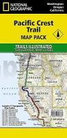
Pacific Crest Trail Kartenset mit 11 Karten 1:75.000 (Blatt 1002, 1003, 1004, 1005, 1006, 1007, 1008, 1009, 1010, 1011, 1012) Topographic Map Guide Bundle - USA Trails IIllustrated / National Geographic
EAN / ISBN: 9781566958165
Preis: EUR 139.90
|
|


