Willkommen bei MapFox
Wurde Ihre Bestellung bestätigt? Wenn nicht - gab es evtl. ein SERVER-Problem! Bitte kontaktieren Sie uns! +++ Buchhändler-Anfragen erwünscht +++
Warenkorb
Artikel: 0 - € 0.00
Zur Kasse
Impressum Kontakt Versandkosten AGB
Pikes Peak - Canon City - Trails Illustrated Map (Blatt 137) National Geographic Maps
<< USA: Wanderkarten, Nationalpark-Karten
<< National Geographic
 
Cover

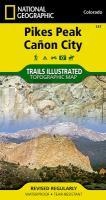
The Pikes Peak/Canon City Trails Illustrated map is the most comprehensive recreational map for this popular 14er and surrounding area west of Colorado Springs. Coverage includes: Pike National Forest; Beaver Creek and McIntyre Hills Wilderness Study Area; Mueller State Park; Florissant Fossil Beds National Monument; Red Canyon and Royal Gorge Parks; cities of Colorado Springs, Woodland Park, Manitou Springs, Lake George, Tarryall, Parkdale, Canon City, Victor, Cripple Creek and Gillette; Elevenmile, North Slope, Skagway and Rampart reservoirs; Arkansas River; Fountain Creek and Beaver Creek; and the U.S. Air Force Academy. 14ers: Pikes Peak.

Kartenausschnitt

Kartenbeispiel

Pikes Peak - Canon City - Trails Illustrated Map (Blatt 137) National Geographic Maps
EAN / ISBN: 9781566953986
Preis: EUR 16.95

Bestellartikel: versandfertig in ca. 3-7 Tagen. Dieser Artikel wird speziell für Sie bestellt. Keine Rücknahme!
Produkt EUR Anzahl Bestellen
Pikes Peak - Canon City - Trails Illustrated Map (Blatt 137) National Geographic Maps 16.95
Versandkostenfrei in Deutschland ab 30,- Bestellwert

incl. MwSt.

Stichworte, die bei der Suche nützlich sein könnten:
Canon City - Pikes Peak - Canon City - USA Wanderkarten - USA Landkarten - USA Nationalparks - USA National Parks - USA maps - Vereinigte Staaten Landkarten - USA Nationalpark-Karten - National Geographic - National Geographic Landkarten

Zuletzt angesehene Artikel:

CoverPikes Peak - Canon City - Trails Illustrated Map (Blatt 137) National Geographic Maps

CoverVerona Stadtplan 1:13.000
Verona - Pianta della Citta L.A.C. GlobalMap Italien

CoverEverest: A Trekker`s Guide - Trekking Routes in Nepal and Tibet - Wanderführer Himalaya - Cicerone (englisch)

CoverAlaska Road & Recreation Atlas 1:316.800-1:1.267.200 - Benchmark Atlas USA