| << USA: Bundesstaaten-Landkarten << Delorme |
||
|
||

Zuletzt angesehene Artikel:
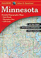
 | Minnesota & Gazetteer - Topographischer Straßenatlas Delorme Publishing Company DELORME MAPPING USA |
 | P.N. de Cabañeros Wanderkarte 1:25.000 Nationalparks Spanien - CNIG Spanien |
 | 384 Mont Emilius 1:25.000 e Valle Centrale - Wanderkarte - Italien - 4land Carta Topografica Escursionistica 4land |
 | 6520 Waldbrunn Topographische Landkarte 1:25.000 - Landesvermessungsamt Baden-Württemberg |
 | 2 Isergebirge - Friedland Wanderkarte Tschechien 1:50.000 Jizerské hory, Frýdlantsko - SHOCart |
 | Duisburg (S) - Rheinhausen & Wedau 1944 Alte Stadtpläne des Rheinlandes Old maps of the Rhineland Alan Godfrey Maps |
 | 128 Taunton & Blackdown Hills - Wanderkarte Großbritannien 1:25.000 EXPLORER MAP - Ordnance Survey |
 | 197 Chichester & The South Downs - Bognor Regis & Arundel - Wanderkarte Großbritannien 1:50.000 LANDRANGER MAP - Ordnance Survey |
 | 4 Bassa Valle Susa - Musiné - Val Sangone - Collina di Rivoli Topographische Wanderkarte und Straßenkarte 1:25.000 Fraternali Editore - Italien |
 | L2546 Woldegk Topographische Karte 1:50.000 (Regelblattschnitt) Landesvermessungsamt Brandenburg |
 | Novi Sad Stadtplan mit Sehenswürdigkeiten 1:10.000 Novi Sad Plan grada - Vazna i interesantna mesta Magic Map Serbien |
 | Revierführer - Kroatische Adria mit Slowenien und Montenegro - von Wolfgang Albrecht - Motorbuch |
 | Lychen - Fürstenberg/Havel - Radwanderkarte - Wanderkarte - Paddelkarte (Blatt 141) Klemmer-Pocket, 1:50.000, GPS geeignet, Freizeit-Tipps auf der Rückseite Klemmer-Verlag |
 | 102 VALL DE BOI 1:35.000 Touristische Landkarte Spanien - Geo / Estel |
| BD32 Topographische Landkarte Neuseeland 1:50.000 Land Information New Zealand |
 | L6706 Saarbrücken West Topographische Karte 1:50.000 - Landesvermessungsamt Saarland |
 | 7422 Lenningen Topographische Landkarte 1:25.000 - Landesvermessungsamt Baden-Württemberg |
 | Die 50 schönsten Aussichtsplätze in den Allgäuer Alpen von Peter Nowotny - AVA Agrar-Verlag Allgäu |
 | 127 Stafford & Telford - Ironbridge - Wanderkarte Großbritannien 1:50.000 LANDRANGER MAP - Ordnance Survey |