
| << USA: Bundesstaaten-Landkarten << Delorme |
||
|
||

Zuletzt angesehene Artikel:
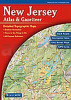
 | New Jersey & Gazetteer - Topographischer Straßenatlas Delorme Publishing Company DELORME MAPPING USA |
 | Frankreich Luftfahrtkarte OACI Südwest 1:500.000 (aktuelle Ausgabe) IGN - Frankreich |
 | Calvados - Le Bessin à pied Wanderführer - (französisch) Chamina - Frankreich |
 | Orjol (Orel) Stadtplan 1:14.000 - Russland Orel - Karta Goroda Rus Co. Ltd. |
 | Eigerwand - A Climber`s Guide to the 1938 Heckmair Route Kletterführer - Rick Kollath - Kollath Graphic Design |
 | 35-c Topographische Landkarte Georgien 1:50.000 Geoland Maps Georgien |
 | Kanada - Westen - mit Süd-Alaska Reisehandbuch - Iwanowski´s Reisebuchverlag |
 | Samokov - Borowez 1:8000 / 1:9500 Ski-Panoramakarte und Wanderkarte 1:50.000 Borovets - Samokov - Sommer Tourist Routes - Ski Runs - Travel Guide Domino Bulgarien |
 | 49C KRABBENDIJKE Topographische Karte der Niederlande 1:25.000 (Plotausgabe) 49C KRABBENDIJKE Topografische Kaart van Nederland Kadaster - ProjektNord |
 | Sachsenwald (geplottete Ausgabe) *** SCHNÄPPCHEN *** Topographische Wanderkarte mit Wanderwegen und Radwegen 1:25.000 - ProjektNord |
 | Bolschaja Laba 1:100.000 Topographische Wanderkarte - Russland Большая Лаба - Топографическая карта FGUP 11 Voenno kartografičeskaja čast´ - 11 WKCh |
 | NS509 Guerilla Trek (Nepal) Trekkingkarte 1:150.000 (aka, The Shangrila Trek) with Dhorpatan Hunting Reserve - Yarsagumba Trail - Phalgunedhuri - Jaljala - Himalayan MapHouse - Nepal |
 | 02C NES (Ameland) Topographische Karte der Niederlande 1:25.000 (Plotausgabe) 02C NES Topografische Kaart van Nederland Kadaster - ProjektNord |
 | Hanstedter Berge Topographische Wanderkarte mit Wanderwegen und Radwegen 1:25.000 Niedersachsen - ProjektNord |