Willkommen bei MapFox
Wurde Ihre Bestellung bestätigt? Wenn nicht - gab es evtl. ein SERVER-Problem! Bitte kontaktieren Sie uns! +++ Buchhändler-Anfragen erwünscht +++
Warenkorb
Artikel: 0 - € 0.00
Zur Kasse
Widerruf Impressum Kontakt Versandkosten AGB
Western Texas Recreation Map 1:1.013.760 - Landkarte Benchmark Map USA
<< USA: Wanderkarten, Nationalpark-Karten
<< Benchmark
 
Cover

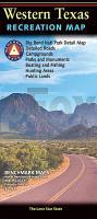
The Western Texas Recreation Map is the first map product to show the real richness of recreation potential in The Lone Star State. One side provides a Western Texas map that features land cover (forest, grassland, cropland, & wetland), extensive highway detail, point-to-point mileages, recreation sites, Roadside America attractions, campgrounds, parks & wildlife areas, boating & fishing access points, and public hunting areas. This side also includes an area map of Big Bend National Park. The reverse side features categorized recreation listings with helpful descriptions, current contact information, and map grid references.

Western Texas Recreation Map 1:1.013.760 - Landkarte Benchmark Map USA
EAN / ISBN: 9780783499178
Preis: EUR 11.90

Bestellartikel: versandfertig in ca. 1-3 Wochen. Dieser Artikel wird speziell für Sie bestellt. Keine Rücknahme!
Produkt EUR Anzahl Bestellen
Western Texas Recreation Map 1:1.013.760 - Landkarte Benchmark Map USA 11.90
Versandkostenfrei in Deutschland ab 30,- Bestellwert

incl. MwSt.

Stichworte, die bei der Suche nützlich sein könnten:
USA Wanderkarten - USA Landkarten - USA Nationalparks - USA National Parks - USA maps - Vereinigte Staaten Landkarten - USA Nationalpark-Karten - Benchmark - Benchmark Recreation maps - Benchmark Road Maps - Benchmark Roadatlases - Benchmark Atlanten - USA Atlanten - USA Recreation Atlases - Bundesstaatenkarten USA - Amerikanische Bundesstaaten - Vereinigte Staaten von Amerika Landkarte - US maps - US states maps

Zuletzt angesehene Artikel:

CoverWestern Texas Recreation Map 1:1.013.760 - Landkarte Benchmark Map USA

CoverGDT - Great Desert Tracks Atlas & Guide *** SCHNÄPPCHEN *** (2010) HEMA Maps

CoverFöhr und Amrum - Reise Know-How InselTrip Reiseführer mit Insel-Faltplan und kostenloser Web-App - von Hans-Jürgen Fründt - Reise Know-How

CoverJaroslawl Stadtplan 1:25.000 - Russland
Jaroslavl

CoverVélodyssée de Roscoff à Hendaye Radwanderführer (französisch) Guide du Routard

CoverOstallgäu - Allgäuer Alpen - Lechtal 1:50.000 Wanderkarte + Freizeitkarte - GeoMap

CoverZauberhafte Welt der Formen PRESSOGRAM Zaubertafel Vorschule PRODESIGN Lernspiel GmbH

CoverSirubari 1:50.000 - Panchase - Karkineta - Trekking Map - Nepal Map Publisher Pvt. Ltd.

CoverLibyen 1:1.6 Mio. Landkarte Reise-Know-How Verlag - world mapping project

CoverDie Furcht des Weisen. Teil 1 Roman. - von Patrick Rothfuss - Klett-Cotta Verlag

CoverWandern auf Mallorca Reiseführer Reise-Know-How Verlag

CoverComo Stadtplan 1:10.000
Como - Pianta della Citta L.A.C. GlobalMap Italien

CoverSwetlogorsk Stadtplan 1: 6.000 - Russland
Svetlogorsk FGUP Balt AGP

CoverRome & the Vatican - laminierter Stadtplan + Ministadtführer (engl.) comfort!map & guide
Rome & the Vatican miniguide ExpressMap
