Willkommen bei MapFox
Wurde Ihre Bestellung bestätigt? Wenn nicht - gab es evtl. ein SERVER-Problem! Bitte kontaktieren Sie uns! +++ Buchhändler-Anfragen erwünscht +++
Warenkorb
Artikel: 0 - € 0.00
Zur Kasse
Impressum Kontakt Versandkosten AGB
Rakiura Track Map & North West Circuit, Stewart Island 1:50.000 + Track Guide Wanderkarte - Neuseeland Geographx - Craig Potton Publishing Neuseeland
<< Neuseeland
<< Potton & Burton / Craig Potton Publishing
 
Cover

Escape on an island adventure and exchange the hustle and bustle of mainland life for the tranquility of the Rakiura Track on Stewart Island/Rakiura. Revel in the peacefulness and idyllic surroundings with the bush, birds and beach at your side.
The Rakiura Track is located on Stewart Island/Rakiura National Park. Travelling to Stewart Island/Rakiura either by a short scenic flight from Invercargill or taking the ferry service across Foveaux Strait will offer ample opportunities to view a variety of sea birds. Both options land you in the heart of the island’s only township, Oban
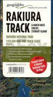
Features:

- Additional Stewart Island & Rakiura National Park 3D Map on reverse
- Award-winning relief mapping
- Track notes, elevation and distance graphic
- Printed on waterproof, durable, environmentally sustainable `Rockstock` paper.

Kartenbeispiel aus der Serie

Mit zusätzlicher Panoramakarte der ganzen Stewart-Insel.

Kartenausschnitt

Rakiura Track Map & North West Circuit, Stewart Island 1:50.000 + Track Guide Wanderkarte - Neuseeland Geographx - Craig Potton Publishing Neuseeland
EAN / ISBN: 9416458075308
Preis: EUR 24.90

Dieser Titel ist momentan nicht lieferbar.
Produkt EUR Anzahl Bestellen
Rakiura Track Map & North West Circuit, Stewart Island 1:50.000 + Track Guide Wanderkarte - Neuseeland Geographx - Craig Potton Publishing Neuseeland 24.90
Versandkostenfrei in Deutschland ab 30,- Bestellwert

incl. MwSt.

Stichworte, die bei der Suche nützlich sein könnten:
Stewart Island Trekkingkarte - Rakiura Track Map - Rakiura Trekkingkarte - Rakiura Wanderkarte - New Zealand - Stewart Island Wanderkarte Neuseeland - Stewart Island - Neuseeland Wanderkarte - Rakiura Nationalpark - Rakiura National Park - Neuseeland - Neuseeland Wanderkarten - Neuseeland Karten - Neuseeland Radwanderführer - Neuseeland Kartographie - Neuseeland Landkarten - Neuseeland Fahrradkarten - Neuseelandkarten - Neuseeland Atlanten - Neuseeland Landkartenverkauf - Neuseeland Reiseführer - Neuseeland Straßenkarten - Neuseeland Kartografie - Neuseeland Radwanderkarten - New Zealand - New Zealand Radwanderkarten - New Zealand Kartographie - New Zealand Landkarten - New Zealand Straßenkarten - New Zealand Fahrradkarten - New Zealandkarten - New Zealand Reiseführer - New Zealand Radwanderführer - New Zealand Kartografie - New Zealand Atlanten - New Zealand Landkartenverkauf - New Zealand Wanderkarten - New Zealand Karten - Neuseeland Wanderkarten - Neuseland Wanderführer - Neuseeland Trekkingführer - New Zealand - Neuseeland - Craig Potton Publishing - Craig Potton Landkarten - Craig Potton Trekkingkarten - Neuseeland Nationalpark-Karten - Neuseeland Karten - Neuseeland Wandern - New Zealand hiking maps - New Zealand trekking - New Zealand national parks

Zuletzt angesehene Artikel:

CoverRakiura Track Map & North West Circuit, Stewart Island 1:50.000 + Track Guide Wanderkarte - Neuseeland Geographx - Craig Potton Publishing Neuseeland

Cover5352 Tannheimer Tal 1:35.000 Wanderkarte freytag & berndt

CoverIsland Peak - Nepal - Imja Tse (GPS) 1:20.000 Bergsteigerkarte Nepal - Gecko Maps

CoverDolomiten 55 Skitouren für Einsteiger und Genießer - Rother Skiführer - Bergverlag Rother

Cover127 Le colline di Forlì 1:50.000 - Topographische Wanderkarte - Monti editore - Italien

CoverALGARVE - Regionalkarte Portugal 1:176.000 + 6 Stadtpläne (Blatt SR5) - Turinta

CoverMünsterland Radregion 1:75.000 bikeline Radwanderführer - Esterbauer

CoverYorkshire 3 Peaks Challenge Map - Super-Durable Map Wanderkarte (wasserfest) Discovery Walking Guides Ltd

CoverWalking in Sicily Short and long-distance walks - Wanderführer - Cicerone (englisch)

CoverDUMONT direkt Mallorca von Kunze, Gabriela

Cover1252 AMBRI-PIOTTA 1:25.000 - Lago Ritóm - Passo del Lucomagno - Faido - Topographische Landeskarte der Schweiz - swisstopo

CoverSkiResort Map of the Alps 1:1.4 Mio by Roger Lascelles Maps Ltd.

CoverDonauradweg - Passau - Bratislava - Radatlas 1:125.000 - freytag & berndt

Cover918 Frankreich zu Pferde 1:1 Mio. Landkarte
FRANCE TOURISME EQUESTRE IGN - Frankreich

CoverBahamas 1:500.000 (wasserfest) Landkarte - ITMB International Travel Maps (engl.)

CoverSt. Kitts (St. Christofer) + Nevis 1:30.000 / 1:20.000 - Landkarte - Street map - GMP - Geographic Map Publishing - midok - Michal Kasprowsky

CoverPorto CityTrip Reiseführer mit Faltplan und kostenloser Web-App - von Petra Sparrer - Reise Know-How

CoverRund um Island OutdoorHandbuch - Der Weg ist das Ziel (Band 192) - Richter / Stein - Conrad-Stein-Verlag

CoverLowther Hills walking guide Wanderführer Schottland - Cicerone Großbritannien (englisch)

CoverMünster CityTrip - mit Krimi Special Reiseführer von Christopher Görlich - Reise-Know-How