Willkommen bei MapFox
Wurde Ihre Bestellung bestätigt? Wenn nicht - gab es evtl. ein SERVER-Problem! Bitte kontaktieren Sie uns! +++ Buchhändler-Anfragen erwünscht +++
Warenkorb
Artikel: 0 - € 0.00
Zur Kasse
Impressum Kontakt Versandkosten AGB
Lake Waikaremoana Track 1:40.000 + Track Guide Wanderkarte - Neuseeland Geographx - Craig Potton Publishing Neuseeland
<< Neuseeland
<< Potton & Burton / Craig Potton Publishing
 
Cover

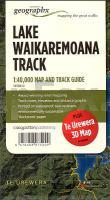
A refuge amongst prehistoric rainforest with access to some of New Zealand’s most iconic birds, this Great Walk around the shoreline of Lake Waikaremoana is truly outstanding. Be awed by the vistas from Panekire Bluff, stumble upon beautiful remote beaches and be enchanted by the area’s fascinating cultural history.

Lake Waikaremoana is situated in the heart of Te Urewera National Park, on the eastern side of the North Island. Follow the lake shore on this 3 - 4 day, 46 km track through immaculate native rainforest, visit beautiful remote beaches and touch your imagination with its fascinating cultural history.

Features:

- Additional Te Urewera 3D Map on reverse
- Award-winning relief mapping Track notes, elevation and distance graphic
- Printed on waterproof, durable, environmentally sustainable ´Rockstock´ paper.

Kartenbeispiel aus der Serie

Mit zusätzlicher Panoramakarte der weiteren Umgebung

Kartenausschnitt

Lake Waikaremoana Track 1:40.000 + Track Guide Wanderkarte - Neuseeland Geographx - Craig Potton Publishing Neuseeland
EAN / ISBN: 9416458075209
Preis: EUR 24.90

sofort versandfertig Dieser Artikel ist im Normalfall sofort lieferbar.
Produkt EUR Anzahl Bestellen
Lake Waikaremoana Track 1:40.000 + Track Guide Wanderkarte - Neuseeland Geographx - Craig Potton Publishing Neuseeland 24.90
Versandkostenfrei in Deutschland ab 30,- Bestellwert

incl. MwSt.

Stichworte, die bei der Suche nützlich sein könnten:
New Zealand - Lake Waikaremoana - Neuseeland - Lake Waikaremoana Track - Neuseeland - Neuseeland Wanderkarten - Neuseeland Karten - Neuseeland Radwanderführer - Neuseeland Kartographie - Neuseeland Landkarten - Neuseeland Fahrradkarten - Neuseelandkarten - Neuseeland Atlanten - Neuseeland Landkartenverkauf - Neuseeland Reiseführer - Neuseeland Straßenkarten - Neuseeland Kartografie - Neuseeland Radwanderkarten - New Zealand - New Zealand Radwanderkarten - New Zealand Kartographie - New Zealand Landkarten - New Zealand Straßenkarten - New Zealand Fahrradkarten - New Zealandkarten - New Zealand Reiseführer - New Zealand Radwanderführer - New Zealand Kartografie - New Zealand Atlanten - New Zealand Landkartenverkauf - New Zealand Wanderkarten - New Zealand Karten - Neuseeland Wanderkarten - Neuseland Wanderführer - Neuseeland Trekkingführer - New Zealand - Neuseeland - Craig Potton Publishing - Craig Potton Landkarten - Craig Potton Trekkingkarten - Neuseeland Nationalpark-Karten - Neuseeland Karten - Neuseeland Wandern - New Zealand hiking maps - New Zealand trekking - New Zealand national parks

Zuletzt angesehene Artikel:

CoverLake Waikaremoana Track 1:40.000 + Track Guide Wanderkarte - Neuseeland Geographx - Craig Potton Publishing Neuseeland

Noch kein Cover vorhanden4445-SW Topographische Karte 1:10.000 - Landesvermessungsamt Brandenburg

Noch kein Cover vorhanden265.12 Amtliche topographische Karte 1:25.000 Polen

Noch kein Cover vorhanden413.43 Amtliche topographische Karte 1:25.000 Polen

CoverBaedeker Reiseführer Slowenien von Schulze Dr., Dieter

Noch kein Cover vorhanden183.3 Amtliche topographische Karte 1:50.000 Polen

CoverIdaho Road & Recreation Atlas 1:250.000-1:800.000 - Benchmark Atlas USA

Noch kein Cover vorhanden403.32 Amtliche topographische Karte 1:25.000 Polen

CoverWanderkarten Set Tschechien (1:40.000) 72 Karten im Maßstab 1:40 000 - SHOCart

Noch kein Cover vorhanden253.4 Amtliche topographische Karte 1:50.000 Polen

Noch kein Cover vorhanden355.23 Amtliche topographische Karte 1:25.000 Polen

CoverVier-Länder-Grenzradweg 1:50.000, 162 km, GPS-Tracks Download, Live-Update - Esterbauer

CoverSouthern Upland Way - Scotland`s coast to coast trail Wanderführer - Cicerone (englisch)

Noch kein Cover vorhanden443.3 Amtliche topographische Karte 1:50.000 Polen

Noch kein Cover vorhanden421.11 Amtliche topographische Karte 1:25.000 Polen

CoverLeipzig Mittlere Ausgabe - Stadtplan 1:15.000 mit Kurzreiseführer - Pharus-Plan

Noch kein Cover vorhanden341.4 Amtliche topographische Karte 1:50.000 Polen

CoverWandern auf Fontanes Wegen - von Wiebrecht, Ulrike - via reise

CoverAmalfitana - Island Pocket + The Big Five 1:40.000 - freytag & berndt

Noch kein Cover vorhanden352.31 Amtliche topographische Karte 1:25.000 Polen