| << WeiÃrussland: Wanderkarten << Polen: Wanderkarten: Ostpolen << PTOP - Polen |
||
|
||


Zuletzt angesehene Artikel:
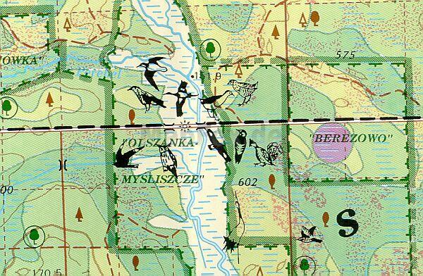
 | Bialowieza-Urwald (WeiÃrussischer Teil) 1:50.000 naturkundliche Landkarte Belawetschskaja Puschtscha - Puszcza Bialowieska - PTOP |
 | 2811 08 Jatuni Topographische Karte 1:20.000 (Maastokartta / Peruskartta / Grundkarta) Maanmittauslaitos / Lantmäteriverket Finnland - ProjektNord |
 | Fietsland Nederland - de ideale fietsplanner 1:75.000 - fietsatlas spiral - Fietsersbond Fahrradatlas Niederlande Bike Country Netherlands - the ideal bicycle planner Buijten & Schipperheijn |
 | 2391 Grammen Topographische Karte 1:25.000 Messtischblatt des Deutschen Reiches - PreuÃische Landesaufnahme / Reichsamt für Landesaufnahme - Faksimile ProjektNord |
 | 0203-4 ENTRENA Topographische Landkarte 1:25.000 Spanien (Grundlage MTN25) Instituto Geográfico Nacional - CNIG Spanien - ProjektNord |
 | Livorno Provinzialautokarte - StraÃenkarte 1:100.000 - Italien Livorno - Carta stradale della Provincia L.A.C. GlobalMap Italien |
 | 0350-1 SORIA Topographische Landkarte 1:25.000 Spanien (Grundlage MTN25) Instituto Geográfico Nacional - CNIG Spanien - ProjektNord |
 | 0371-1 MOTA DEL MARQUÃS Topographische Landkarte 1:25.000 Spanien (Grundlage MTN25) Instituto Geográfico Nacional - CNIG Spanien - ProjektNord |
| 1731 Oldenburg in Holstein - Gestern und Heute - Historische Ãberlagerung 1932-1950 Topographische Landkarte 1:25.000 im Vergleich - Landesvermessungsamt Schleswig-Holstein / ProjektNord |
 | 0540-3 OREA Topographische Landkarte 1:25.000 Spanien (Grundlage MTN25) Instituto Geográfico Nacional - CNIG Spanien - ProjektNord |
| Moletai (75-79/40-44) Topografische Karte Litauen 1:50.000 Lietuvos Respublikos Topografinis Zemelapis 1:50.000 - Nacionaline Zemes Tarnyba - Litauen |
 | Albtäler-Radweg, Schwäbische Alb Leporello Radtourenkarte mit Ausflugszielen, Einkehr- & Freizeittipps, wetterfest, reiÃfest, abwischbar, GPS-genau. 1 : 50 000 - von - PUBLICPRESS |
| 2528 Geesthacht - Gestern und Heute - Historische Ãberlagerung 1932-1950 Topographische Landkarte 1:25.000 im Vergleich - Landesvermessungsamt Schleswig-Holstein / ProjektNord |
 | 58C THORN Topographische Karte der Niederlande 1:25.000 (Plotausgabe) 58C THORN Topografische Kaart van Nederland Kadaster - ProjektNord |
 | 0879 PEÃARROYA-PUEBLONUEVO Topographische Landkarte 1:50.000 Spanien (Grundlage MTN50) Instituto Geográfico Nacional - CNIG Spanien - ProjektNord |
 | 0404-4 LICERAS Topographische Landkarte 1:25.000 Spanien (Grundlage MTN25) Instituto Geográfico Nacional - CNIG Spanien - ProjektNord |
 | 3434 06 Ristijärvi Topographische Karte 1:20.000 (Maastokartta / Peruskartta / Grundkarta) Maanmittauslaitos / Lantmäteriverket Finnland - ProjektNord |
 | 0692 CAMPILLO DE ALTOBUEY Topographische Landkarte 1:50.000 Spanien (Grundlage MTN50) Instituto Geográfico Nacional - CNIG Spanien - ProjektNord |
 | Irkutsker Oblast - StraÃenatlas 1:1 Mio./1:500.000/1:200.000 Иркутская област FGUP Vostočno sibirskoe aerogeodezičekoe predprijatie |
 | 1030-4 LUCAINENA DE LAS TORRES Topographische Landkarte 1:25.000 Spanien (Grundlage MTN25) Instituto Geográfico Nacional - CNIG Spanien - ProjektNord |