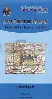
| << Portugal: Amtliche topografische Landkarten des Instituto Geográfico do Exército (IGeoE) 1:25.000 (Serie M888) |
||
|
||

Zuletzt angesehene Artikel:
 | 579 Sao Barnabe (Almodovar) Topographische Landkarte Portugal 1:25.000 Carta Militar de Portugal - Série M888 Instituto Geográfico do Exército (IGeoE) - Portugal |
 | 2122 01 Lavia Topographische Karte 1:20.000 (Maastokartta / Peruskartta / Grundkarta) Maanmittauslaitos / Lantmäteriverket Finnland - ProjektNord |
 | 3044 02+05 Vaalimaa Topographische Karte 1:20.000 (Maastokartta / Peruskartta / Grundkarta) Maanmittauslaitos / Lantmäteriverket Finnland - ProjektNord |
 | 188-2 SOBER Amtliche topographische Landkarte 1:25.000 Spanien (M.T.N.) 188-2 Mapa Topográfico Nacional de Espana (MTN25) Instituto Geográfico Nacional - CNIG Spanien |
 | 2242 02 Kukonkylä Topographische Karte 1:20.000 (Maastokartta / Peruskartta / Grundkarta) Maanmittauslaitos / Lantmäteriverket Finnland - ProjektNord |
 | 260 Topographische Landkarte Wanderkarte und Fahrradkarte Portugal 1:25.000 260 Mapa topográfico - Mapa de caminhadas - Portugal 1:25.000 ProjektNord |
 | M10 Markt Indersdorf - Altomünster, Erdweg, Kühbach, Gerolsbach, Hilgertshausen-Tandern ATK25 Topographische Karte 1:25.000 (Atkis) Bayern Landesvermessungsamt Bayern - Wanderkarte |
 | 17 Lindoso (Pnte da Barca) - Topographische Landkarte Portugal 1:25.000 Carta Militar de Portugal - Série M888 Instituto Geográfico do Exército (IGeoE) - Portugal |
 | 891-3 CIEZA Amtliche topographische Landkarte 1:25.000 Spanien (M.T.N.) 891-3 Mapa Topográfico Nacional de Espana (MTN25) Instituto Geográfico Nacional - CNIG Spanien |
 | 631-1 OCAÃA Amtliche topographische Landkarte 1:25.000 Spanien (M.T.N.) 631-1 Mapa Topográfico Nacional de Espana (MTN25) Instituto Geográfico Nacional - CNIG Spanien |
 | 1332 02 Panike Topographische Karte 1:20.000 (Maastokartta / Peruskartta / Grundkarta) Maanmittauslaitos / Lantmäteriverket Finnland - ProjektNord |
 | 0767 CARCELÃN Topographische Landkarte 1:50.000 Spanien (Grundlage MTN50) Instituto Geográfico Nacional - CNIG Spanien - ProjektNord |
 | NL 33-02-15 West (4215-West) Kalwang Ãsterreichische Karte 1:25.000 mit Wegmarkierungen (topographische Wanderkarte - UTM) - BEV - Ãsterreich - VergröÃerung (ÃK25V) |
 | 3441 02 Oterma, Topographische Karte 1:20.000 (Maastokartta / Peruskartta / Grundkarta) Maanmittauslaitos / Lantmäteriverket Finnland - ProjektNord |
 | NL 33-05-14 Ost (4114-Ost) Bad Eisenkappel Ãsterreichische Karte 1:25.000 mit Wegmarkierungen (topographische Wanderkarte - UTM) - BEV - Ãsterreich - VergröÃerung (ÃK25V) |
 | 226 Topographische Landkarte Wanderkarte und Fahrradkarte Portugal 1:25.000 226 Mapa topográfico - Mapa de caminhadas - Portugal 1:25.000 ProjektNord |
| NM 33-11-04 Ost (4304-Ost) Waidhofen an der Thaya Ãsterreichische Karte 1:25.000 mit Wegmarkierungen (topographische Wanderkarte - UTM) - BEV - Ãsterreich - VergröÃerung (ÃK25V) |
 | 284 Topographische Landkarte Wanderkarte und Fahrradkarte Portugal 1:25.000 284 Mapa topográfico - Mapa de caminhadas - Portugal 1:25.000 ProjektNord |
| M-33-42-A/B Bogatynnia Amtliche topographische Landkarte Polen 1:50.000 M-33-42-A/B Bogatynnia - Mapa Topograficzna Polski Glowny Geodeta Kraju |