| << Portugal: Amtliche topografische Landkarten des Instituto Geográfico do Exército (IGeoE) 1:25.000 (Serie M888) |
||
|
||

Zuletzt angesehene Artikel:
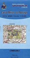
 | 528 - Topographische Landkarte Portugal 1:25.000 Carta Militar de Portugal - Série M888 Instituto Geográfico do Exército (IGeoE) - Portugal |
 | U422 Kangosjärvi Topographische Karte 1:50.000 EUREF-FIN (Maastokarttat) Maanmittauslaitos / Lantmäteriverket Finnland - ProjektNord |
 | 3541 07 Iso-Syöte Topographische Karte 1:20.000 (Maastokartta / Peruskartta / Grundkarta) Maanmittauslaitos / Lantmäteriverket Finnland - ProjektNord |
 | 2228 Steinburg - Gestern und Heute - Historische Ãberlagerung 1902-1930 Topographische Landkarte 1:25.000 im Vergleich - Landesvermessungsamt Schleswig-Holstein / ProjektNord |
 | Achaia - Topografische Landkarte Peloponnes - Griechenland 1:100.000 (Blatt 13) GPS - Peloponnese Achaia - Αχαïα - Touring map - ΠΕΡΙΗΓΗΤΙΚΟΣ ΧΑΡΤΗΣ - Anavasi - Griechenland |
 | 0896-4 FUENTES DE LEÃN Topographische Landkarte 1:25.000 Spanien (Grundlage MTN25) Instituto Geográfico Nacional - CNIG Spanien - ProjektNord |
 | 0929-4 CANAL DE SAN CLEMENTE Topographische Landkarte 1:25.000 Spanien (Grundlage MTN25) Instituto Geográfico Nacional - CNIG Spanien - ProjektNord |
 | S10 Mittenwald - Krün - Soierngruppe - Karwendelgebirge-West, Scharnitz, Leutaschtal ATK25 Topographische Karte 1:25.000 (Atkis) Bayern Landesvermessungsamt Bayern - Wanderkarte - Radwanderkarte |
 | 0993-2 BAÃL Topographische Landkarte 1:25.000 Spanien (Grundlage MTN25) Instituto Geográfico Nacional - CNIG Spanien - ProjektNord |
 | 0076-2 POLA DE SOMIEDO Topographische Landkarte 1:25.000 Spanien (Grundlage MTN25) Instituto Geográfico Nacional - CNIG Spanien - ProjektNord |
 | 0694-4 EL REATILLO Topographische Landkarte 1:25.000 Spanien (Grundlage MTN25) Instituto Geográfico Nacional - CNIG Spanien - ProjektNord |
 | 0761-3 CASA DON JUAN Topographische Landkarte 1:25.000 Spanien (Grundlage MTN25) Instituto Geográfico Nacional - CNIG Spanien - ProjektNord |
 | Küddow 1:100.000 Touristische Landkarte, Flusskarte, Wassersportkarte - Polen Gwda - mapa kajakowa GPS 3D EKO-Map - Polen |
 | 0929 CANAL DE SAN CLEMENTE Topographische Landkarte 1:50.000 Spanien (Grundlage MTN50) Instituto Geográfico Nacional - CNIG Spanien - ProjektNord |
 | 1035 VILLAMARTÃN Topographische Landkarte 1:50.000 Spanien (Grundlage MTN50) Instituto Geográfico Nacional - CNIG Spanien - ProjektNord |
 | 0687 VILLACAÃAS Topographische Landkarte 1:50.000 Spanien (Grundlage MTN50) Instituto Geográfico Nacional - CNIG Spanien - ProjektNord |
 | 0321-3 MALLÃN Topographische Landkarte 1:25.000 Spanien (Grundlage MTN25) Instituto Geográfico Nacional - CNIG Spanien - ProjektNord |
 | 0445 LA SELVA DEL CAMP Topographische Landkarte 1:50.000 Spanien (Grundlage MTN50) Instituto Geográfico Nacional - CNIG Spanien - ProjektNord |
 | KOMPASS Fahrrad-Tourenkarte Etschradweg - Ciclabile dell´Adige 1:50.000 Von Landeck über Meran bis Verona. GPX-Datei zum Download, Leporello Karte, reiÃ- und wetterfest - KOMPASS-Karten |
 | 0175-2 SIGÃÃS Topographische Landkarte 1:25.000 Spanien (Grundlage MTN25) Instituto Geográfico Nacional - CNIG Spanien - ProjektNord |