| << Portugal: Amtliche topografische Landkarten des Instituto Geográfico do Exército (IGeoE) 1:25.000 (Serie M888) |
||
|
||

Zuletzt angesehene Artikel:
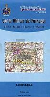
 | 525-A - Topographische Landkarte Portugal 1:25.000 Carta Militar de Portugal - Série M888 Instituto Geográfico do Exército (IGeoE) - Portugal |
 | 1043 01 Innamo Topographische Karte 1:20.000 (Maastokartta / Peruskartta / Grundkarta) Maanmittauslaitos / Lantmäteriverket Finnland - ProjektNord |
 | 165-1 SOTOBAÃADO Y PRIORATO Amtliche topographische Landkarte 1:25.000 Spanien (M.T.N.) 165-1 Mapa Topográfico Nacional de Espana (MTN25) Instituto Geográfico Nacional - CNIG Spanien |
 | 449-3 SAUCELLE Amtliche topographische Landkarte 1:25.000 Spanien (M.T.N.) 449-3 Mapa Topográfico Nacional de Espana (MTN25) Instituto Geográfico Nacional - CNIG Spanien |
 | WSH Schwäbisch Hall - Backnang (Blatt 08) Topographische Wanderkarte 1:35.000 mit touristischen Informationen - Karte des Schwäbischen Albvereins - Blatt 8 -Landesvermessungsamt Baden-Württemberg |
 | 3959 Züllichau Topographische Karte 1:25.000 Messtischblatt des Deutschen Reiches - PreuÃische Landesaufnahme / Reichsamt für Landesaufnahme - Faksimile ProjektNord |
 | 199-4 ISAR Amtliche topographische Landkarte 1:25.000 Spanien (M.T.N.) 199-4 Mapa Topográfico Nacional de Espana (MTN25) Instituto Geográfico Nacional - CNIG Spanien |
 | MN06 Retezat Gebirge 1:50.000 Topographische Wanderkarte - Bergwanderkarte (englisch / rumänisch) Harta de drumeţie / Hiking Map - RETEZAT Muntii Nostri - Schubert & Franzke - Rumänien |
 | 942-3 EL PRIORATO Amtliche topographische Landkarte 1:25.000 Spanien (M.T.N.) 942-3 Mapa Topográfico Nacional de Espana (MTN25) Instituto Geográfico Nacional - CNIG Spanien |
| NM 33-11-04 (4304) Waidhofen an der Thaya Ãsterreichische Karte 1:50.000 mit Wegmarkierungen (topographische Wanderkarte - UTM) - BEV - Ãsterreich |
 | NL 33-04-10 West (3110-West) Kötschach-Mauthen Ãsterreichische Karte 1:25.000 mit Wegmarkierungen (topographische Wanderkarte - UTM) - BEV - Ãsterreich - VergröÃerung (ÃK25V) |
 | Umgebung von Schreiberhau - Jakuszyce - Harrachsdorf (Tschechien / Polen) 1:25.000 GPS Wanderkarte laminiert Szklarska Poreba - Jakuszyce - Harrachov - mapa turystyczna PLAN Galileos - Polen |
| 1870 Bütow Topographische Karte 1:25.000 Messtischblatt des Deutschen Reiches - PreuÃische Landesaufnahme / Reichsamt für Landesaufnahme - Faksimile ProjektNord |
 | 5009 Overath - Wanderkarte mit Wanderwegen (geplottete Ausgabe) ProjektNord - Grundlage Amtliche topographische Karte 1:25.000 Landesvermessungsamt Nordrhein-Westfalen |
 | 0376 SAN ESTEBAN DE GORMAZ Topographische Landkarte 1:50.000 Spanien (Grundlage MTN50) Instituto Geográfico Nacional - CNIG Spanien - ProjektNord |
| 1173 Wittenberg i. Pommern Topographische Karte 1:25.000 Messtischblatt des Deutschen Reiches - PreuÃische Landesaufnahme / Reichsamt für Landesaufnahme - Faksimile ProjektNord |
| NL 33-03-01 Ost (5201-Ost) Wiener Neustadt Ãsterreichische Karte 1:25.000 mit Wegmarkierungen (topographische Wanderkarte - UTM) - BEV - Ãsterreich - VergröÃerung (ÃK25V) |
 | 0975-2 CAMPO LÃPEZ Topographische Landkarte 1:25.000 Spanien (Grundlage MTN25) Instituto Geográfico Nacional - CNIG Spanien - ProjektNord |
 | 0098-2 FURÃS Topographische Landkarte 1:25.000 Spanien (Grundlage MTN25) Instituto Geográfico Nacional - CNIG Spanien - ProjektNord |
 | 0485-2 PUEBLA DE VALLES Topographische Landkarte 1:25.000 Spanien (Grundlage MTN25) Instituto Geográfico Nacional - CNIG Spanien - ProjektNord |