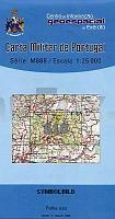
| << Portugal: Amtliche topografische Landkarten des Instituto Geográfico do Exército (IGeoE) 1:25.000 (Serie M888) |
||
|
||

Zuletzt angesehene Artikel:
 | 510 - Topographische Landkarte Portugal 1:25.000 Carta Militar de Portugal - Série M888 Instituto Geográfico do Exército (IGeoE) - Portugal |
 | 226 - Topographische Landkarte Portugal 1:25.000 Carta Militar de Portugal - Série M888 Instituto Geográfico do Exército (IGeoE) - Portugal |
 | 3111 02 Renkomäki Topographische Karte 1:20.000 (Maastokartta / Peruskartta / Grundkarta) Maanmittauslaitos / Lantmäteriverket Finnland - ProjektNord |
 | 1242 10 Pörtom Topographische Karte 1:20.000 (Maastokartta / Peruskartta / Grundkarta) Maanmittauslaitos / Lantmäteriverket Finnland - ProjektNord |
 | 4611 05 Noukavaara Topographische Karte 1:20.000 (Maastokartta / Peruskartta / Grundkarta) Maanmittauslaitos / Lantmäteriverket Finnland - ProjektNord |
 | NL 32-03-30 Ost (2230-Ost) Mayrhofen Ãsterreichische Karte 1:25.000 mit Wegmarkierungen (topographische Wanderkarte - UTM) - BEV - Ãsterreich - VergröÃerung (ÃK25V) |
 | 4332 02 Lieksa Topographische Karte 1:20.000 (Maastokartta / Peruskartta / Grundkarta) Maanmittauslaitos / Lantmäteriverket Finnland - ProjektNord |
 | 383 - Topographische Landkarte Portugal 1:25.000 Carta Militar de Portugal - Série M888 Instituto Geográfico do Exército (IGeoE) - Portugal |
 | 1021 07 Saltvik Topographische Karte 1:20.000 (Maastokartta / Peruskartta / Grundkarta) Maanmittauslaitos / Lantmäteriverket Finnland - ProjektNord |
 | Baisogala (55-59/50-54) Topografische Karte Litauen 1:50.000 Lietuvos Respublikos Topografinis Zemelapis 1:50.000 - Nacionaline Zemes Tarnyba - Litauen |
 | 0083-2 SAN MIGUEL DE LUENA Topographische Landkarte 1:25.000 Spanien (Grundlage MTN25) Instituto Geográfico Nacional - CNIG Spanien - ProjektNord |
 | 0999-4 PALOS DE LA FRONTERA Topographische Landkarte 1:25.000 Spanien (Grundlage MTN25) Instituto Geográfico Nacional - CNIG Spanien - ProjektNord |
 | 2041 06 Vihti Topographische Karte 1:20.000 (Maastokartta / Peruskartta / Grundkarta) Maanmittauslaitos / Lantmäteriverket Finnland - ProjektNord |
 | NL 32-03-15 Ost (2215-Ost) Zugspitze Ãsterreichische Karte 1:25.000 mit Wegmarkierungen (topographische Wanderkarte - UTM) - BEV - Ãsterreich - VergröÃerung (ÃK25V) |
 | 3321 03 PITKÃKANGAS Topographische Karte 1:20.000 (Maastokartta / Peruskartta / Grundkarta) Maanmittauslaitos / Lantmäteriverket Finnland - ProjektNord |
 | 2441 10 Kopsa Topographische Karte 1:20.000 (Maastokartta / Peruskartta / Grundkarta) Maanmittauslaitos / Lantmäteriverket Finnland - ProjektNord |
 | NL 33-05-07 (4107) Klagenfurt Ãsterreichische Karte 1:50.000 mit Wegmarkierungen (topographische Wanderkarte - UTM) - BEV - Ãsterreich |
 | 0114-1 LAKUNTZA Topographische Landkarte 1:25.000 Spanien (Grundlage MTN25) Instituto Geográfico Nacional - CNIG Spanien - ProjektNord |
 | 88 Topographische Landkarte Wanderkarte und Fahrradkarte Portugal 1:25.000 088 Mapa topográfico - Mapa de caminhadas - Portugal 1:25.000 ProjektNord |
| Erläuterungen zur Geologischen Karte 4541 Eilenburg - Ausgabe 1920 Sächsisches Landesamt für Umwelt, Landwirtschaft und Geologie |