| << Portugal: Amtliche topografische Landkarten des Instituto Geográfico do Exército (IGeoE) 1:25.000 (Serie M888) |
||
|
||

Zuletzt angesehene Artikel:
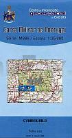
 | 496 - Topographische Landkarte Portugal 1:25.000 Carta Militar de Portugal - Série M888 Instituto Geográfico do Exército (IGeoE) - Portugal |
 | 632-1 CLARICAS Amtliche topographische Landkarte 1:25.000 Spanien (M.T.N.) 632-1 Mapa Topográfico Nacional de Espana (MTN25) Instituto Geográfico Nacional - CNIG Spanien |
 | 47 - Topographische Landkarte Portugal 1:25.000 Carta Militar de Portugal - Série M888 Instituto Geográfico do Exército (IGeoE) - Portugal |
 | M17 Pfarrkirchen mit Bad Birnbach, Triftern, Dietersburg, Postmünster, Tann, Wittibreut *** SCHNÃPPCHEN *** ATK25 Topographische Karte 1:25.000 (Atkis) Bayern Landesvermessungsamt Bayern - Wanderkarte |
 | 0171-1 AGUILAR DE CODÃS Topographische Landkarte 1:25.000 Spanien (Grundlage MTN25) Instituto Geográfico Nacional - CNIG Spanien - ProjektNord |
 | 662-2 ALBALADEJO DEL CUENDE Amtliche topographische Landkarte 1:25.000 Spanien (M.T.N.) 662-2 Mapa Topográfico Nacional de Espana (MTN25) Instituto Geográfico Nacional - CNIG Spanien |
 | LANDKARTEN Krieg 1866 - Karten - Schlachten - Pläne - Skizzen - Marschrouten (Nr. 43) - Historische Landkarte Ãsterreichs Kämpfe im Jahre 1866 6. Band von 6 - PLANO gerollt - Verlag Rockstuhl |
 | 413-I Quinto Amtliche topographische Landkarte 1:25.000 Spanien (M.T.N.) 413-I Mapa Topográfico Nacional de Espana (MTN25) Instituto Geográfico Nacional - CNIG Spanien |
 | 0577 BOHOYO Topographische Landkarte 1:50.000 Spanien (Grundlage MTN50) Instituto Geográfico Nacional - CNIG Spanien - ProjektNord |
 | 2131 02 Vuohiniemi Topographische Karte 1:20.000 (Maastokartta / Peruskartta / Grundkarta) Maanmittauslaitos / Lantmäteriverket Finnland - ProjektNord |
 | 4331 08 Höntönvaara Topographische Karte 1:20.000 (Maastokartta / Peruskartta / Grundkarta) Maanmittauslaitos / Lantmäteriverket Finnland - ProjektNord |
 | 0081-3 PORTILLA DE LA REINA Topographische Landkarte 1:25.000 Spanien (Grundlage MTN25) Instituto Geográfico Nacional - CNIG Spanien - ProjektNord |
 | 33 Topographische Landkarte Wanderkarte und Fahrradkarte Portugal 1:25.000 033 Mapa topográfico - Mapa de caminhadas - Portugal 1:25.000 ProjektNord |
 | 201 - Topographische Landkarte Portugal 1:25.000 Carta Militar de Portugal - Série M888 Instituto Geográfico do Exército (IGeoE) - Portugal |
 | 563-2 PRIEGO Amtliche topographische Landkarte 1:25.000 Spanien (M.T.N.) 563-2 Mapa Topográfico Nacional de Espana (MTN25) Instituto Geográfico Nacional - CNIG Spanien |
 | NL 33-01-24 Ost (3224-Ost) Kleinsölk Ãsterreichische Karte 1:25.000 mit Wegmarkierungen (topographische Wanderkarte - UTM) - BEV - Ãsterreich - VergröÃerung (ÃK25V) |
 | 0770-3 VILLANUEVA DE CASTELLÃN Topographische Landkarte 1:25.000 Spanien (Grundlage MTN25) Instituto Geográfico Nacional - CNIG Spanien - ProjektNord |
 | 11H OOSTERWOLDE Topographische Karte der Niederlande 1:25.000 (Plotausgabe) 11H OOSTERWOLDE Topografische Kaart van Nederland Kadaster - ProjektNord |
 | 784-4 BALLESTEROS DE CALATRAVA Amtliche topographische Landkarte 1:25.000 Spanien (M.T.N.) 784-4 Mapa Topográfico Nacional de Espana (MTN25) Instituto Geográfico Nacional - CNIG Spanien |
 | Mt. Parnassos - Topographische Bergwanderkarte Griechenland 1:35.000 (Blatt 2.1) - Central Greece Anavasi - Griechenland Παρνασσος - Parnassos - ΠΕΖΟΠΟΡΙΚΟΣ ΧΑΡΤΗΣ - Touring & Hiking Map |