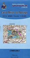
| << Portugal: Amtliche topografische Landkarten des Instituto Geográfico do Exército (IGeoE) 1:25.000 (Serie M888) |
||
|
||

Zuletzt angesehene Artikel:
 | 483 - Topographische Landkarte Portugal 1:25.000 Carta Militar de Portugal - Série M888 Instituto Geográfico do Exército (IGeoE) - Portugal |
 | 0485-4 ROBLEDILLO DE MOHERNANDO Topographische Landkarte 1:25.000 Spanien (Grundlage MTN25) Instituto Geográfico Nacional - CNIG Spanien - ProjektNord |
 | NM 33-11-27 Ost (4327-Ost) Amstetten Ãsterreichische Karte 1:25.000 mit Wegmarkierungen (topographische Wanderkarte - UTM) - BEV - Ãsterreich - VergröÃerung (ÃK25V) |
 | 164-2 BUENAVISTA DE VALDAVIA Amtliche topographische Landkarte 1:25.000 Spanien (M.T.N.) 164-2 Mapa Topográfico Nacional de Espana (MTN25) Instituto Geográfico Nacional - CNIG Spanien |
 | NL 33-02-08 West (4208-West) Spital am Pyhrn Ãsterreichische Karte 1:25.000 mit Wegmarkierungen (topographische Wanderkarte - UTM) - BEV - Ãsterreich - VergröÃerung (ÃK25V) |
 | 2142 02 Enokunta Topographische Karte 1:20.000 (Maastokartta / Peruskartta / Grundkarta) Maanmittauslaitos / Lantmäteriverket Finnland - ProjektNord |
 | 27 Belgische Küste - bicycle junction maps Knotenpunkte-Fahrradkarte 1:100.000 Fietsknooppuntenkaart 27 ANWB - Belgien |
 | Baikalsee Süd 1:200.000 - Baikalsee 1:1 Mio. Topographische Karte - Russland Karta Juznoje Pribaikalje - Karta Osera Baikal - Map of Southern Pribaikalie - Map of Lake Baikal |
 | 379 - Topographische Landkarte Portugal 1:25.000 Carta Militar de Portugal - Série M888 Instituto Geográfico do Exército (IGeoE) - Portugal |
 | 527-1 TAMAMES Amtliche topographische Landkarte 1:25.000 Spanien (M.T.N.) 527-1 Mapa Topográfico Nacional de Espana (MTN25) Instituto Geográfico Nacional - CNIG Spanien |
 | 3711 06 ISO-SOTKA Topographische Karte 1:20.000 (Maastokartta / Peruskartta / Grundkarta) Maanmittauslaitos / Lantmäteriverket Finnland - ProjektNord |
 | 0496 HORTA DE SANT JOAN Topographische Landkarte 1:50.000 Spanien (Grundlage MTN50) Instituto Geográfico Nacional - CNIG Spanien - ProjektNord |
 | 0634 SAN LORENZO DE LA PARRILLA Topographische Landkarte 1:50.000 Spanien (Grundlage MTN50) Instituto Geográfico Nacional - CNIG Spanien - ProjektNord |
 | 190 Topographische Landkarte Wanderkarte und Fahrradkarte Portugal 1:25.000 190 Mapa topográfico - Mapa de caminhadas - Portugal 1:25.000 ProjektNord |
 | 0932 COY Topographische Landkarte 1:50.000 Spanien (Grundlage MTN50) Instituto Geográfico Nacional - CNIG Spanien - ProjektNord |
 | 1025-2 CASTILLO DE TAJARJA Topographische Landkarte 1:25.000 Spanien (Grundlage MTN25) Instituto Geográfico Nacional - CNIG Spanien - ProjektNord |
 | 141 - Topographische Landkarte Portugal 1:25.000 Carta Militar de Portugal - Série M888 Instituto Geográfico do Exército (IGeoE) - Portugal |
 | 1008-2 MONTEFRÃO Topographische Landkarte 1:25.000 Spanien (Grundlage MTN25) Instituto Geográfico Nacional - CNIG Spanien - ProjektNord |
 | Werratal-Radweg - Radwander- und Wanderkarte mit Zick‑Zack‑Faltung 1:35.000 (Nr. 170) Von den Quellen in Thüringen über Meiningen, Bad Salzungen, Heringen und Eschwege zur Mündung in Hann. Münden mit ausgewählten StraÃennamen - Dr. Barthel Verlag |
| 5571 Friedland O. S. Topographische Karte 1:25.000 Messtischblatt des Deutschen Reiches - PreuÃische Landesaufnahme / Reichsamt für Landesaufnahme - Faksimile ProjektNord |