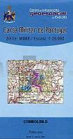
| << Portugal: Amtliche topografische Landkarten des Instituto Geográfico do Exército (IGeoE) 1:25.000 (Serie M888) |
||
|
||

Zuletzt angesehene Artikel:
 | 474 - Topographische Landkarte Portugal 1:25.000 Carta Militar de Portugal - Série M888 Instituto Geográfico do Exército (IGeoE) - Portugal |
 | 2833 04 Lisma Topographische Karte 1:20.000 (Maastokartta / Peruskartta / Grundkarta) Maanmittauslaitos / Lantmäteriverket Finnland - ProjektNord |
 | 420-2 Rubà Amtliche topographische Landkarte 1:25.000 Spanien (M.T.N.) 420-2 Mapa Topográfico Nacional de Espana (MTN25) Instituto Geográfico Nacional - CNIG Spanien |
 | 871-2 AGOST Amtliche topographische Landkarte 1:25.000 Spanien (M.T.N.) 871-2 Mapa Topográfico Nacional de Espana (MTN25) Instituto Geográfico Nacional - CNIG Spanien |
 | Herzogtümer Schleswig, Holstein und Lauenburg 1865- Historische Landkarte Nachdruck Planokarte - gerollt - von A.Gräf - Verlag Rockstuhl |
 | 1143 08 Kullaa Topographische Karte 1:20.000 (Maastokartta / Peruskartta / Grundkarta) Maanmittauslaitos / Lantmäteriverket Finnland - ProjektNord |
 | 4908 Burscheid - Wanderkarte mit Wanderwegen (geplottete Ausgabe) ProjektNord - Grundlage Amtliche topographische Karte 1:25.000 Landesvermessungsamt Nordrhein-Westfalen |
 | 13101 Stallupönen Topographische Karte 1:25.000 Messtischblatt des Deutschen Reiches - PreuÃische Landesaufnahme / Reichsamt für Landesaufnahme - Faksimile ProjektNord |
| NL 33-02-04 West (4204-West) Lunz am See Ãsterreichische Karte 1:25.000 mit Wegmarkierungen (topographische Wanderkarte - UTM) - BEV - Ãsterreich - VergröÃerung (ÃK25V) |
 | 45-3 CERCEDA Amtliche topographische Landkarte 1:25.000 Spanien (M.T.N.) 45-3 Mapa Topográfico Nacional de Espana (MTN25) Instituto Geográfico Nacional - CNIG Spanien |
 | 1334 02 Pudimo Topographische Karte 1:20.000 (Maastokartta / Peruskartta / Grundkarta) Maanmittauslaitos / Lantmäteriverket Finnland - ProjektNord |
 | Oblast Sumy / Rajon Putywl 1:60.000 Geographische StraÃenkarte Сумська область. Путивльський район Kartografija - ukrmap Ukraine |
 | 37 Topographische Landkarte Wanderkarte und Fahrradkarte Portugal 1:25.000 037 Mapa topográfico - Mapa de caminhadas - Portugal 1:25.000 ProjektNord |
 | 15F LEMMER Topographische Karte der Niederlande 1:25.000 (Plotausgabe) 15F LEMMER Topografische Kaart van Nederland Kadaster - ProjektNord |
 | 264-1 SANDIÃS Amtliche topographische Landkarte 1:25.000 Spanien (M.T.N.) 264-1 Mapa Topográfico Nacional de Espana (MTN25) Instituto Geográfico Nacional - CNIG Spanien |
 | 412 - Topographische Landkarte Portugal 1:25.000 Carta Militar de Portugal - Série M888 Instituto Geográfico do Exército (IGeoE) - Portugal |
| Ofotfjorden - Seekarte Norwegische Küste 1:50.000 - (Blatt 141) Den Norske Kyst Sjøkart - Hovedkart (sjø) Statens Kartverk Sjø - Norwegen |
 | 3731 12 Pyörreselkä Topographische Karte 1:20.000 (Maastokartta / Peruskartta / Grundkarta) Maanmittauslaitos / Lantmäteriverket Finnland - ProjektNord |
 | 3712 06 KUMPUTUNTURI Topographische Karte 1:20.000 (Maastokartta / Peruskartta / Grundkarta) Maanmittauslaitos / Lantmäteriverket Finnland - ProjektNord |
 | 842-4 LIÃTOR Amtliche topographische Landkarte 1:25.000 Spanien (M.T.N.) 842-4 Mapa Topográfico Nacional de Espana (MTN25) Instituto Geográfico Nacional - CNIG Spanien |