| << Portugal: Amtliche topografische Landkarten des Instituto Geográfico do Exército (IGeoE) 1:25.000 (Serie M888) |
||
|
||

Zuletzt angesehene Artikel:
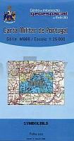
 | 465 - Topographische Landkarte Portugal 1:25.000 Carta Militar de Portugal - Série M888 Instituto Geográfico do Exército (IGeoE) - Portugal |
 | Karpaten-Vorland - 101 touristische Sehenswürdigkeiten - StraÃenkarte 1:200.000 Województwo Podkarpackie 101 atrakcji turystycznych - mapa samochodowo - krajoznawcza Compass - Polen |
 | 2641 02 KITTISVAARA Topographische Karte 1:20.000 (Maastokartta / Peruskartta / Grundkarta) Maanmittauslaitos / Lantmäteriverket Finnland - ProjektNord |
 | 3021 09 Pernå Topographische Karte 1:20.000 (Maastokartta / Peruskartta / Grundkarta) Maanmittauslaitos / Lantmäteriverket Finnland - ProjektNord |
 | 16 Florenville 1:25.000 - 720 km Wanderwege Touristische Landkarte und Wanderkarte, Radwanderkarte, Reitkarte - Mini Ardenne - Belgien Florenville - Chiny - Muno - Abbaye d`Orval |
 | Ãmter Colditz, Leisnig, Rochlitz und das Schulamt Grimma mit Mügeln und Sornzig 1749 (Nr. 5) - historische Landkarte - Nachdruck KURFÃRSTENTUM SACHSEN - LEIPZIGER KREIS - von Peter (der Jüngere) Schenk - Plano gerollt - Verlag Rockstuhl |
 | 3433 03 Rehja Topographische Karte 1:20.000 (Maastokartta / Peruskartta / Grundkarta) Maanmittauslaitos / Lantmäteriverket Finnland - ProjektNord |
 | 208 Topographische Landkarte Wanderkarte und Fahrradkarte Portugal 1:25.000 208 Mapa topográfico - Mapa de caminhadas - Portugal 1:25.000 ProjektNord |
 | 3612 04 Niskanperä Topographische Karte 1:20.000 (Maastokartta / Peruskartta / Grundkarta) Maanmittauslaitos / Lantmäteriverket Finnland - ProjektNord |
 | NM 33-12-13 West (5313-West) Hollabrunn Ãsterreichische Karte 1:25.000 mit Wegmarkierungen (topographische Wanderkarte - UTM) - BEV - Ãsterreich - VergröÃerung (ÃK25V) |
 | 0265-1 O CASTRO DE LAZA Topographische Landkarte 1:25.000 Spanien (Grundlage MTN25) Instituto Geográfico Nacional - CNIG Spanien - ProjektNord |
 | 1031 07 Utö Topographische Karte 1:20.000 (Maastokartta / Peruskartta / Grundkarta) Maanmittauslaitos / Lantmäteriverket Finnland - ProjektNord |
| Mazeikiai (35-39/65-69) Topografische Karte Litauen 1:50.000 Lietuvos Respublikos Topografinis Zemelapis 1:50.000 - Nacionaline Zemes Tarnyba - Litauen |
| NL 33-02-14 West (4214-West) Admont Ãsterreichische Karte 1:25.000 mit Wegmarkierungen (topographische Wanderkarte - UTM) - BEV - Ãsterreich - VergröÃerung (ÃK25V) |
 | Isergebirge (Blatt 23) Topographische Wanderkarte 1:25.000 EUROKART (tschechisch) Jizerské hory - Góry Iserskie - Hejnice - Frýdlant - Nové Město pod Smrkem - Lázně Libverda - Bedřichov - Desná - Ferdinandov - Jizerka - Liberec - Smědava Geodezie On Line - Tschechien |
 | 2011 11 Tvärminne Topographische Karte 1:20.000 (Maastokartta / Peruskartta / Grundkarta) Maanmittauslaitos / Lantmäteriverket Finnland - ProjektNord |
 | 1044 04 Lemu Topographische Karte 1:20.000 (Maastokartta / Peruskartta / Grundkarta) Maanmittauslaitos / Lantmäteriverket Finnland - ProjektNord |
 | 0238-4 REVILLARRUZ Topographische Landkarte 1:25.000 Spanien (Grundlage MTN25) Instituto Geográfico Nacional - CNIG Spanien - ProjektNord |
 | 397 Topographische Landkarte Wanderkarte und Fahrradkarte Portugal 1:25.000 397 Mapa topográfico - Mapa de caminhadas - Portugal 1:25.000 ProjektNord |
| Pogorze Ciezkowickie (Mittlere Beskiden Vorgebirge) 1:50.000 Wanderkarte / Landkarte Polen - Compass - Polen - wasserfest Pogórze Cieżkowickie mapa (wyd. lamin.) |