| << Portugal: Amtliche topografische Landkarten des Instituto Geográfico do Exército (IGeoE) 1:25.000 (Serie M888) |
||
|
||

Zuletzt angesehene Artikel:
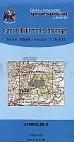
 | 459 - Topographische Landkarte Portugal 1:25.000 Carta Militar de Portugal - Série M888 Instituto Geográfico do Exército (IGeoE) - Portugal |
 | 0569 VILLAFRANCA DEL CID Topographische Landkarte 1:50.000 Spanien (Grundlage MTN50) Instituto Geográfico Nacional - CNIG Spanien - ProjektNord |
 | Madeira und Porto Santo - Reiseführer Mit Funchal, Porto Moniz, Cabo Girão, Ponta de São Lourenço - Mit vielen Ausflügen und Wanderungen - von Hartung, Ray - TRESCHER |
 | 4158 Schweinitz Reg. Bez. Liegnitz Topographische Karte 1:25.000 Messtischblatt des Deutschen Reiches - PreuÃische Landesaufnahme / Reichsamt für Landesaufnahme - Faksimile ProjektNord |
 | Nationalpark Warthemündung - Polen Topographische Wanderkarte und Touristische Landkarte 1:25.000 Park Narodowy Ujście Warty ProjektNord |
 | 0732-2 SAN SIMÃN Topographische Landkarte 1:25.000 Spanien (Grundlage MTN25) Instituto Geográfico Nacional - CNIG Spanien - ProjektNord |
 | 4406 Dinslaken (geplottete Ausgabe) Amtliche topographische Karte 1:25.000 Landesvermessungsamt Nordrhein-Westfalen |
 | NL 32-02-23 Ost (1223-Ost) Feldkirch Ãsterreichische Karte 1:25.000 mit Wegmarkierungen (topographische Wanderkarte - UTM) - BEV - Ãsterreich - VergröÃerung (ÃK25V) |
 | 261 - Topographische Landkarte Portugal 1:25.000 Carta Militar de Portugal - Série M888 Instituto Geográfico do Exército (IGeoE) - Portugal |
 | Combrailles à pied + VTT - Auvergne Wanderführer - Mountainbikeführer (französisch) Combrailles à pied + VTT - Auvergne - Balades à pied Chamina - Frankreich |
 | 0400 ÃSCAR Topographische Landkarte 1:50.000 Spanien (Grundlage MTN50) Instituto Geográfico Nacional - CNIG Spanien - ProjektNord |
 | 0215 LA SEU DURGELL Topographische Landkarte 1:50.000 Spanien (Grundlage MTN50) Instituto Geográfico Nacional - CNIG Spanien - ProjektNord |
 | NM 33-11-15 West (4315-West) Karlstift Ãsterreichische Karte 1:25.000 mit Wegmarkierungen (topographische Wanderkarte - UTM) - BEV - Ãsterreich - VergröÃerung (ÃK25V) |
 | 473 Westliche Tatra - Hohe Tatra - Belaer Tatra (Zoom) Wanderkarte Slowakei 1:40.000 - SHOCart Zapadné Tatry - Vysoké Tatry - Belianske Tatry - SHOCart |
 | 7 GreenVelo: Woiwodschaft Heiligkreuz 1:100.000 Radwanderkarte der Radwege Nie tylko GreenVelo - mapa tras rowerowych - Wojewodstwo Swietokrzyskie Europilot - Daunpol - Polen |
 | 8241 Ruhpolding Topographische Landkarte Bayern 1:25.000 - Normalausgabe - ProjektNord (geplottete Ausgabe) - Grundlage amtliche Topographische Karte Bayern DTK25 |
 | 39 - Topographische Landkarte Portugal 1:25.000 Carta Militar de Portugal - Série M888 Instituto Geográfico do Exército (IGeoE) - Portugal |
 | 918-2 CALA Amtliche topographische Landkarte 1:25.000 Spanien (M.T.N.) 918-2 Mapa Topográfico Nacional de Espana (MTN25) Instituto Geográfico Nacional - CNIG Spanien |
 | 0793 Skirwiet Topographische Karte 1:25.000 Messtischblatt des Deutschen Reiches - PreuÃische Landesaufnahme / Reichsamt für Landesaufnahme - Faksimile ProjektNord |
 | 3621 08 PERUNKASELKà Topographische Karte 1:20.000 (Maastokartta / Peruskartta / Grundkarta) Maanmittauslaitos / Lantmäteriverket Finnland - ProjektNord |