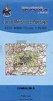
| << Portugal: Amtliche topografische Landkarten des Instituto Geográfico do Exército (IGeoE) 1:25.000 (Serie M888) |
||
|
||

Zuletzt angesehene Artikel:
 | 393 - Topographische Landkarte Portugal 1:25.000 Carta Militar de Portugal - Série M888 Instituto Geográfico do Exército (IGeoE) - Portugal |
 | 416 Sintra Topographische Landkarte Portugal 1:25.000 Carta Militar de Portugal - Série M888 Instituto Geográfico do Exército (IGeoE) - Portugal |
 | 104 - Topographische Landkarte Portugal 1:25.000 Carta Militar de Portugal - Série M888 Instituto Geográfico do Exército (IGeoE) - Portugal |
 | 441-A - Topographische Landkarte Portugal 1:25.000 Carta Militar de Portugal - Série M888 Instituto Geográfico do Exército (IGeoE) - Portugal |
 | 27 Belgische Küste - bicycle junction maps Knotenpunkte-Fahrradkarte 1:100.000 Fietsknooppuntenkaart 27 ANWB - Belgien |
 | 221 - Tábua - Topographische Landkarte Portugal 1:25.000 Carta Militar de Portugal - Série M888 Instituto Geográfico do Exército (IGeoE) - Portugal |
 | 503 - Topographische Landkarte Portugal 1:25.000 Carta Militar de Portugal - Série M888 Instituto Geográfico do Exército (IGeoE) - Portugal |
 | 509 Topographische Landkarte Wanderkarte und Fahrradkarte Portugal 1:25.000 509 Mapa topográfico - Mapa de caminhadas - Portugal 1:25.000 ProjektNord |
 | 373 - Topographische Landkarte Portugal 1:25.000 Carta Militar de Portugal - Série M888 Instituto Geográfico do Exército (IGeoE) - Portugal |
 | 29 Gelderse Poort - Fahrradkarte 1:66.666 Gelderse Poort fietskaart Gelderse Poort - ANWB fietskaart 29 - ANWB - Niederlande |
 | 521 Topographische Landkarte Wanderkarte und Fahrradkarte Portugal 1:25.000 521 Mapa topográfico - Mapa de caminhadas - Portugal 1:25.000 ProjektNord |
 | 117 - Topographische Landkarte Portugal 1:25.000 Carta Militar de Portugal - Série M888 Instituto Geográfico do Exército (IGeoE) - Portugal |
 | 447 - Topographische Landkarte Portugal 1:25.000 Carta Militar de Portugal - Série M888 Instituto Geográfico do Exército (IGeoE) - Portugal |
 | 153 - Topographische Landkarte Portugal 1:25.000 Carta Militar de Portugal - Série M888 Instituto Geográfico do Exército (IGeoE) - Portugal |
 | 158 - Topographische Landkarte Portugal 1:25.000 Carta Militar de Portugal - Série M888 Instituto Geográfico do Exército (IGeoE) - Portugal |
 | 423 - Topographische Landkarte Portugal 1:25.000 Carta Militar de Portugal - Série M888 Instituto Geográfico do Exército (IGeoE) - Portugal |
 | 422 - Topographische Landkarte Portugal 1:25.000 Carta Militar de Portugal - Série M888 Instituto Geográfico do Exército (IGeoE) - Portugal |
 | 497 Odivelas Topographische Landkarte Wanderkarte und Fahrradkarte Portugal 1:25.000 497 Mapa topográfico - Mapa de caminhadas - Portugal 1:25.000 ProjektNord |
 | 50 - Topographische Landkarte Portugal 1:25.000 Carta Militar de Portugal - Série M888 Instituto Geográfico do Exército (IGeoE) - Portugal |
 | 263 Topographische Landkarte Wanderkarte und Fahrradkarte Portugal 1:25.000 263 Mapa topográfico - Mapa de caminhadas - Portugal 1:25.000 ProjektNord |