| << Portugal: Amtliche topografische Landkarten des Instituto Geográfico do Exército (IGeoE) 1:25.000 (Serie M888) |
||
|
||

Zuletzt angesehene Artikel:
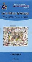
 | 277 - Topographische Landkarte Portugal 1:25.000 Carta Militar de Portugal - Série M888 Instituto Geográfico do Exército (IGeoE) - Portugal |
 | Reisen in Mosambik *** SCHNÃPPCHEN *** Mosambik Komplett mit allen Nationalparks, interessanten Allradstrecken und wertvollen GPS-Daten - Reiseführer von Ilona Hupe und Manfred Vachal - Ilona Hupe Verlag |
 | 1088 Cranz Topographische Karte 1:25.000 Messtischblatt des Deutschen Reiches - PreuÃische Landesaufnahme / Reichsamt für Landesaufnahme - Faksimile ProjektNord |
 | Mosel-Radweg, Perl - Koblenz Leporello Radtourenkarte mit Ausflugszielen, Einkehr- & Freizeittipps, wetterfest, reiÃfest, abwischbar, GPS-genau. 1:50000 - von - Freytag-Berndt und ARTARIA Publicpress |
 | 1010 PURULLENA Topographische Landkarte 1:50.000 Spanien (Grundlage MTN50) Instituto Geográfico Nacional - CNIG Spanien - ProjektNord |
 | 52D HELENAVEEN Topographische Karte der Niederlande 1:25.000 (Plotausgabe) 52D HELENAVEEN Topografische Kaart van Nederland Kadaster - ProjektNord |
 | 0843 HELLÃN Topographische Landkarte 1:50.000 Spanien (Grundlage MTN50) Instituto Geográfico Nacional - CNIG Spanien - ProjektNord |
 | NL 33-02-08 Ost (4208-Ost) Sankt Gallen Ãsterreichische Karte 1:25.000 mit Wegmarkierungen (topographische Wanderkarte - UTM) - BEV - Ãsterreich - VergröÃerung (ÃK25V) |
 | 1012 10 Flaka Topographische Karte 1:20.000 (Maastokartta / Peruskartta / Grundkarta) Maanmittauslaitos / Lantmäteriverket Finnland - ProjektNord |
 | 0748 ILLA DES CONILLS Topographische Landkarte 1:50.000 Spanien (Grundlage MTN50) Instituto Geográfico Nacional - CNIG Spanien - ProjektNord |
 | 1019-2 LOS PALACIOS Y VILLAFRANCA Amtliche topographische Landkarte 1:25.000 Spanien (M.T.N.) 1019-2 Mapa Topográfico Nacional de Espana (MTN25) Instituto Geográfico Nacional - CNIG Spanien |