| << Portugal: Amtliche topografische Landkarten des Instituto Geográfico do Exército (IGeoE) 1:25.000 (Serie M888) |
||
|
||

Zuletzt angesehene Artikel:
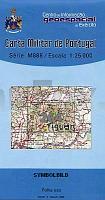
 | 264 Castanheira de Pêra 1:25.000 Carta Militar de Portugal - Série M888 Instituto Geográfico do Exército (IGeoE) - Portugal |
 | 5314 Rennerod - Wanderkarte mit Wanderwegen (geplottete Ausgabe) ProjektNord - Grundlage Amtliche topographische Karte Landesamt für Vermessung und Geobasisinformation Rheinland-Pfalz |
 | L16 Reisbach mit Arnstorf - Eichendorf Landau a. d. Isar - Malgersdorf - Mamming - Simbach ATK25 Topographische Karte 1:25.000 (Atkis) Bayern Landesvermessungsamt Bayern - Wanderkarte |
 | 03-33 Mlada Boleslav Topographische Karte 1:50.000 der Tschechischen Republik Zakladnà mapa Ceská republika - Cesky urad zememericky a katastralni - ProjektNord |
 | 11-3 Tachov (Tachau) Topographische Karte 1:100.000 der Tschechischen Republik Zakladnà mapa Ceská republika - Cesky urad zememericky a katastralni - ProjektNord |
 | 15W STAVOREN (West) Topographische Karte der Niederlande 1:50.000 Topografische Dienst (Plotausgabe) |
 | Dalarnas län Terräng CD (4) Topographische Landkarte Schweden 1:50.000 auf CD-ROM Kartförlaget Schweden |
 | 595 Grenzenlos zwischen Bayerischem Chiemsee und Tiroler Kaisergebirge 1:50.000 Radwanderkarte Fritsch Landkarten-Verlag |
 | K14: Tafraoute - Amtoudi - Aït Mansour - Tanalt 1:120.000 + GPS-Waypoints Marokko Touristische Karte - www.marokko-erfahren.de - ProjektNord |
 | Sentiers Vignerons des Bouches-du-Rhône - 20 circuits dont 16 adaptés à la marche nordique - Réf. P134 Topographischer Wanderführer - FFRP (Fédération française de randonnée pédestre) Frankreich |
 | Mystische Pyrenäen-Pässe per Rad - vom Mittelmeer zum Atlantik Radwanderführer mit 7 Radwanderkarten - von Pere Gómez Puertos Miticos del Pirineo en bicicleta (Guia + 7 Mapas) - La gran travesÃa cicloturista del Mediterráneo al Atlántico Spanien ALPINA |
 | 5520 Nidda - Wanderkarte mit Wanderwegen (geplottete Ausgabe) Topographische Landkarte Hessen 1:25.000 - ProjektNord (geplottete Ausgabe) |
 | CC 3918 Hannover Topographische Ãbersichtskarte 1:200.000 - Bundesamt für Kartografie und Geodäsie und Landesvermessungsämter - ProjektNord |
 | Oberes Volmetal 1:25.000 - Wanderkarte Halver, Kierspe, Lüdenscheid, Meinerzhagen, Schalksmühle - mr-kartographie - Verlag grünes herz |
 | 21-22 Holysov Topographische Karte 1:50.000 der Tschechischen Republik Zakladnà mapa Ceská republika - Cesky urad zememericky a katastralni - ProjektNord |
 | Arhnem / Nijmegen alle fietsroutes in de regio Fahrradkarte Niederlande Buijten & Schipperheijn |
 | Sotschi - Adler - Tuapse - Schwarzmeeküste Stadtpläne 1:17.000 / 1:20.000 / 1:13.000 - Umgebung 1:300.000 Russland Sochi - Adler - Tuapse - Tschernomorskoje Pobereschje Geodom - Russland |
 | 65 Breitenfelde - Nusse - Varendorfsche Karte 1789-1792 Topographisch Militärische Charte des Herzogtums Holstein - Reproduktion 1:25.000 |
 | Vulkaneifel um Gerolstein - Topographische Wanderkarte 1:25.000 (Blatt 19) Offizielle Wanderkarte des Eifelvereins - Kartengrundlage Landesvermessungsamt Rheinland-Pfalz |
 | Sørøya Topographische Wanderkarte Topo 3000 - 1:50.000 (Blatt 3048) - Nordeca - Norwegen |