| << Portugal: Amtliche topografische Landkarten des Instituto Geográfico do Exército (IGeoE) 1:25.000 (Serie M888) |
||
|
||

Zuletzt angesehene Artikel:
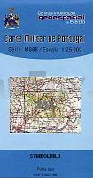
 | 251 - Topographische Landkarte Portugal 1:25.000 Carta Militar de Portugal - Série M888 Instituto Geográfico do Exército (IGeoE) - Portugal |
 | 0025-1 A VEIGA / VEGADEO Topographische Landkarte 1:25.000 Spanien (Grundlage MTN25) Instituto Geográfico Nacional - CNIG Spanien - ProjektNord |
 | 761-2 LLANOS DEL CAUDILLO Amtliche topographische Landkarte 1:25.000 Spanien (M.T.N.) 761-2 Mapa Topográfico Nacional de Espana (MTN25) Instituto Geográfico Nacional - CNIG Spanien |
 | NL 33-05-14 (4114) Bad Eisenkappel Ãsterreichische Karte 1:50.000 mit Wegmarkierungen (topographische Wanderkarte - UTM) - BEV - Ãsterreich |
 | 1006-1 CASARICHE Topographische Landkarte 1:25.000 Spanien (Grundlage MTN25) Instituto Geográfico Nacional - CNIG Spanien - ProjektNord |
 | Sauerland Erlebnisführer mit Informationen zu Freizeiteinrichtungen auf der Kartenrückseite, wetterfest, reiÃfest, abwischbar, GPS-genau. 1:130.000 - von - Freytag-Berndt und ARTARIA PUBLICPRESS |
 | Insel Tschepele (Budapest - Dunaújváros) Donau Rad-, Wassersport-, Angler- und Wanderkarte 1:30.000 Csepel-sziget (Budapest - Dunaújváros) Biciklis, vizisport-, turista és horgasztérkép Szarvas - Kantona - Dimap |
| Erläuterungen zur Geologischen Karte 5143 Chemnitz - Ausgabe 2010 Sächsisches Landesamt für Umwelt, Landwirtschaft und Geologie |
 | 0441-1 LA ZAIDA Topographische Landkarte 1:25.000 Spanien (Grundlage MTN25) Instituto Geográfico Nacional - CNIG Spanien - ProjektNord |
 | 0179-2 SAN JUAN DE PLAN Topographische Landkarte 1:25.000 Spanien (Grundlage MTN25) Instituto Geográfico Nacional - CNIG Spanien - ProjektNord |
 | 1021-2 PUERTO DE LA ENCINA Topographische Landkarte 1:25.000 Spanien (Grundlage MTN25) Instituto Geográfico Nacional - CNIG Spanien - ProjektNord |
| Leines - Grøtøya - Steigen - Seekarte Norwegische Küste 1:50.000 - (Blatt 67) Den Norske Kyst Sjøkart - Hovedkart (sjø) Statens Kartverk Sjø - Norwegen |
 | 1080 HARÃA Topographische Landkarte 1:50.000 Spanien (Grundlage MTN50) Instituto Geográfico Nacional - CNIG Spanien - ProjektNord |
 | 0561-3 ESCARICHE Topographische Landkarte 1:25.000 Spanien (Grundlage MTN25) Instituto Geográfico Nacional - CNIG Spanien - ProjektNord |
 | 2012 06 Kimito Topographische Karte 1:20.000 (Maastokartta / Peruskartta / Grundkarta) Maanmittauslaitos / Lantmäteriverket Finnland - ProjektNord |
 | 0273-2 BECERRIL DE CAMPOS Topographische Landkarte 1:25.000 Spanien (Grundlage MTN25) Instituto Geográfico Nacional - CNIG Spanien - ProjektNord |
| 1471 Schurow Topographische Karte 1:25.000 Messtischblatt des Deutschen Reiches - PreuÃische Landesaufnahme / Reichsamt für Landesaufnahme - Faksimile ProjektNord |
 | 0082-4 ESPINILLA Topographische Landkarte 1:25.000 Spanien (Grundlage MTN25) Instituto Geográfico Nacional - CNIG Spanien - ProjektNord |
 | 0185-2 PONTEVEDRA Topographische Landkarte 1:25.000 Spanien (Grundlage MTN25) Instituto Geográfico Nacional - CNIG Spanien - ProjektNord |
 | 732-4 VALDECABALLEROS Amtliche topographische Landkarte 1:25.000 Spanien (M.T.N.) 732-4 Mapa Topográfico Nacional de Espana (MTN25) Instituto Geográfico Nacional - CNIG Spanien |