| << Portugal: Amtliche topografische Landkarten des Instituto Geográfico do Exército (IGeoE) 1:25.000 (Serie M888) |
||
|
||

Zuletzt angesehene Artikel:
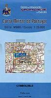
 | 225 - Topographische Landkarte Portugal 1:25.000 Carta Militar de Portugal - Série M888 Instituto Geográfico do Exército (IGeoE) - Portugal |
 | 267-2 EL PUENTE Amtliche topographische Landkarte 1:25.000 Spanien (M.T.N.) 267-2 Mapa Topográfico Nacional de Espana (MTN25) Instituto Geográfico Nacional - CNIG Spanien |
 | 2951 Schwedt Topographische Karte 1:25.000 Messtischblatt des Deutschen Reiches - PreuÃische Landesaufnahme / Reichsamt für Landesaufnahme - Faksimile ProjektNord |
 | 2144 05 OUNINNIEMI Topographische Karte 1:20.000 (Maastokartta / Peruskartta / Grundkarta) Maanmittauslaitos / Lantmäteriverket Finnland - ProjektNord |
 | Costa Smeralda (Sardinien) Touristische StraÃen- und Wanderkarte und nautische Karte 1:65.000 Costa Smeralda L.A.C. GlobalMap Italien |
 | N° 3 BOURGOGNE / FRANCHE-COMTE Kanalführer / Waterways Giude / Guide Fluvial - La Saône, le canal du Centre (versant Saône), le canal de Bourgogne (versant Saône), le canal de la Marne à la Saône (versant Saône), le canal du Rhône au Rhin jusqu`à Dole WasserstraÃen-Führer Frankreich - Ãdition du Breil |
 | 0305-2 SANTA CRUZ DE ABRANES Topographische Landkarte 1:25.000 Spanien (Grundlage MTN25) Instituto Geográfico Nacional - CNIG Spanien - ProjektNord |
 | 2113 04 Forssa Topographische Karte 1:20.000 (Maastokartta / Peruskartta / Grundkarta) Maanmittauslaitos / Lantmäteriverket Finnland - ProjektNord |
| 1685 Braunsberg (Ost) Topographische Karte 1:25.000 Messtischblatt des Deutschen Reiches - PreuÃische Landesaufnahme / Reichsamt für Landesaufnahme - Faksimile ProjektNord |
 | 2011 14 HISSKÃRET Topographische Karte 1:20.000 (Maastokartta / Peruskartta / Grundkarta) Maanmittauslaitos / Lantmäteriverket Finnland - ProjektNord |
 | 0793 Skirwiet Topographische Karte 1:25.000 Messtischblatt des Deutschen Reiches - PreuÃische Landesaufnahme / Reichsamt für Landesaufnahme - Faksimile ProjektNord |
 | 369-2 TORRES DEL CARRIZAL Amtliche topographische Landkarte 1:25.000 Spanien (M.T.N.) 369-2 Mapa Topográfico Nacional de Espana (MTN25) Instituto Geográfico Nacional - CNIG Spanien |
 | 1039-3 CASABERMEJA Topographische Landkarte 1:25.000 Spanien (Grundlage MTN25) Instituto Geográfico Nacional - CNIG Spanien - ProjektNord |
 | 342-1 VILLABRAGIMA Amtliche topographische Landkarte 1:25.000 Spanien (M.T.N.) 342-1 Mapa Topográfico Nacional de Espana (MTN25) Instituto Geográfico Nacional - CNIG Spanien |
 | 0693-3 VILLARGORDO DEL CABRIEL Topographische Landkarte 1:25.000 Spanien (Grundlage MTN25) Instituto Geográfico Nacional - CNIG Spanien - ProjektNord |
 | 729-2 Aldea del Cano Amtliche topographische Landkarte 1:25.000 Spanien (M.T.N.) 729-2 Mapa Topográfico Nacional de Espana (MTN25) Instituto Geográfico Nacional - CNIG Spanien |
 | 556-4 LA RINCONADA Amtliche topographische Landkarte 1:25.000 Spanien (M.T.N.) 556-4 Mapa Topográfico Nacional de Espana (MTN25) Instituto Geográfico Nacional - CNIG Spanien |
 | 181-1 MONTARDO Amtliche topographische Landkarte 1:25.000 Spanien (M.T.N.) 181-1 Mapa Topográfico Nacional de Espana (MTN25) Instituto Geográfico Nacional - CNIG Spanien |
 | 538-1 PERALVECHE Amtliche topographische Landkarte 1:25.000 Spanien (M.T.N.) 538-1 Mapa Topográfico Nacional de Espana (MTN25) Instituto Geográfico Nacional - CNIG Spanien |
 | 54-540 Schorndorf - Göppingen 1:25.000 - Wanderkarte mit Radwegen, Berglen, Ebersbach, Lorch,Plüderhausen,Remshalden,Urbach,Welzheim - NaturNavi |