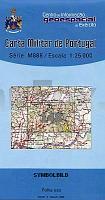
| << Portugal: Amtliche topografische Landkarten des Instituto Geográfico do Exército (IGeoE) 1:25.000 (Serie M888) |
||
|
||

Zuletzt angesehene Artikel:
 | 148 - Topographische Landkarte Portugal 1:25.000 Carta Militar de Portugal - Série M888 Instituto Geográfico do Exército (IGeoE) - Portugal |
 | 295 Topographische Landkarte Wanderkarte und Fahrradkarte Portugal 1:25.000 295 Mapa topográfico - Mapa de caminhadas - Portugal 1:25.000 ProjektNord |
 | 0558-1 NAVALAGAMELLA Topographische Landkarte 1:25.000 Spanien (Grundlage MTN25) Instituto Geográfico Nacional - CNIG Spanien - ProjektNord |
 | 1022-3 EL SAUCEJO Topographische Landkarte 1:25.000 Spanien (Grundlage MTN25) Instituto Geográfico Nacional - CNIG Spanien - ProjektNord |
 | 2014 07 Snappertuna Topographische Karte 1:20.000 (Maastokartta / Peruskartta / Grundkarta) Maanmittauslaitos / Lantmäteriverket Finnland - ProjektNord |
 | 0145-2 SALLENT DE GÃLLEGO Topographische Landkarte 1:25.000 Spanien (Grundlage MTN25) Instituto Geográfico Nacional - CNIG Spanien - ProjektNord |
 | Karte der jüdischen Orte in Polen Der Chassidische Wanderweg 1:900.000 Mapa miejsc zydowskich w Polsce - Szlak Chasydzki / The map of Jewish heritage in Poland - The Chasssidic Route Klezmerhojs Sp. z o. o. |
 | 649-2 ACEHÃCHE Amtliche topographische Landkarte 1:25.000 Spanien (M.T.N.) 649-2 Mapa Topográfico Nacional de Espana (MTN25) Instituto Geográfico Nacional - CNIG Spanien |
 | NL 33-02-13 Ost (4213-Ost) Liezen Ãsterreichische Karte 1:25.000 mit Wegmarkierungen (topographische Wanderkarte - UTM) - BEV - Ãsterreich - VergröÃerung (ÃK25V) |
 | 964-1 EL ACEBUCHAL Amtliche topographische Landkarte 1:25.000 Spanien (M.T.N.) 964-1 Mapa Topográfico Nacional de Espana (MTN25) Instituto Geográfico Nacional - CNIG Spanien |
 | 0296-1 CORNELLà DEL TERRI Topographische Landkarte 1:25.000 Spanien (Grundlage MTN25) Instituto Geográfico Nacional - CNIG Spanien - ProjektNord |
 | 3311 01 VUORILAHTI Topographische Karte 1:20.000 (Maastokartta / Peruskartta / Grundkarta) Maanmittauslaitos / Lantmäteriverket Finnland - ProjektNord |
 | 458 - Topographische Landkarte Portugal 1:25.000 Carta Militar de Portugal - Série M888 Instituto Geográfico do Exército (IGeoE) - Portugal |
 | Priekule (25-29/50-54) Topografische Karte Litauen 1:50.000 Lietuvos Respublikos Topografinis Zemelapis 1:50.000 - Nacionaline Zemes Tarnyba - Litauen |
 | 0438-4 VILLARREAL DE HUERVA Topographische Landkarte 1:25.000 Spanien (Grundlage MTN25) Instituto Geográfico Nacional - CNIG Spanien - ProjektNord |
 | 151 Topographische Landkarte Wanderkarte und Fahrradkarte Portugal 1:25.000 151 Mapa topográfico - Mapa de caminhadas - Portugal 1:25.000 ProjektNord |
 | 0862-3 EL CENTENILLO Topographische Landkarte 1:25.000 Spanien (Grundlage MTN25) Instituto Geográfico Nacional - CNIG Spanien - ProjektNord |
 | 0093-1 BRENS Topographische Landkarte 1:25.000 Spanien (Grundlage MTN25) Instituto Geográfico Nacional - CNIG Spanien - ProjektNord |
 | 0999-1 CARTAYA Topographische Landkarte 1:25.000 Spanien (Grundlage MTN25) Instituto Geográfico Nacional - CNIG Spanien - ProjektNord |
 | 0786-1 MANZANARES Topographische Landkarte 1:25.000 Spanien (Grundlage MTN25) Instituto Geográfico Nacional - CNIG Spanien - ProjektNord |