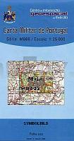
| << Portugal: Amtliche topografische Landkarten des Instituto Geográfico do Exército (IGeoE) 1:25.000 (Serie M888) |
||
|
||

Zuletzt angesehene Artikel:
 | 110 - Maja Topographische Landkarte Portugal 1:25.000 Carta Militar de Portugal - Série M888 Instituto Geográfico do Exército (IGeoE) - Portugal |
 | 363 Aveiras de Cima (Azambuja) Topographische Landkarte Wanderkarte und Fahrradkarte Portugal 1:25.000 363 Mapa topográfico - Mapa de caminhadas - Portugal 1:25.000 ProjektNord |
 | 4207 Raesfeld - Wanderkarte mit Wanderwegen (geplottete Ausgabe) ProjektNord - Grundlage Amtliche topographische Karte 1:25.000 Landesvermessungsamt Nordrhein-Westfalen |
 | 605 Albufeira Topographische Landkarte Portugal 1:25.000 Carta Militar de Portugal - Série M888 Instituto Geográfico do Exército (IGeoE) - Portugal |
 | Herzogtümer Schleswig, Holstein und Lauenburg 1865- Historische Landkarte Nachdruck Planokarte - gerollt - von A.Gräf - Verlag Rockstuhl |
 | 127 Tabuaco - Topographische Landkarte Portugal 1:25.000 Carta Militar de Portugal - Série M888 Instituto Geográfico do Exército (IGeoE) - Portugal |
 | 4716 Bödefeld - Wanderkarte mit Wanderwegen (geplottete Ausgabe) ProjektNord - Grundlage Amtliche topographische Karte 1:25.000 Landesvermessungsamt Nordrhein-Westfalen |
 | NM 33-11-17 West (4317-West) Gföhl Ãsterreichische Karte 1:25.000 mit Wegmarkierungen (topographische Wanderkarte - UTM) - BEV - Ãsterreich - VergröÃerung (ÃK25V) |
 | 237 Topographische Landkarte Wanderkarte und Fahrradkarte Portugal 1:25.000 237 Mapa topográfico - Mapa de caminhadas - Portugal 1:25.000 ProjektNord |
| 1689 Pr. Eylau Topographische Karte 1:25.000 Messtischblatt des Deutschen Reiches - PreuÃische Landesaufnahme / Reichsamt für Landesaufnahme - Faksimile ProjektNord |
 | 4916 Bad Berleburg (geplottete Ausgabe) Amtliche topographische Karte 1:25.000 Landesvermessungsamt Nordrhein-Westfalen |
 | NL 33-02-08 West (4208-West) Spital am Pyhrn Ãsterreichische Karte 1:25.000 mit Wegmarkierungen (topographische Wanderkarte - UTM) - BEV - Ãsterreich - VergröÃerung (ÃK25V) |
 | 4318 Borchen - Wanderkarte mit Wanderwegen (geplottete Ausgabe) ProjektNord - Grundlage Amtliche topographische Karte 1:25.000 Landesvermessungsamt Nordrhein-Westfalen |
 | 4404 Issum - Wanderkarte mit Wanderwegen (geplottete Ausgabe) ProjektNord - Grundlage Amtliche topographische Karte 1:25.000 Landesvermessungsamt Nordrhein-Westfalen |
 | 4019 Detmold - Wanderkarte mit Wanderwegen (geplottete Ausgabe) ProjektNord - Grundlage Amtliche topographische Karte 1:25.000 Landesvermessungsamt Nordrhein-Westfalen |
| NL 33-05-12 Ost (4112-Ost) Bad Radkersburg Ãsterreichische Karte 1:25.000 mit Wegmarkierungen (topographische Wanderkarte - UTM) - BEV - Ãsterreich - VergröÃerung (ÃK25V) |
| 2682 Pokrzydowo Topographische Karte 1:25.000 Messtischblatt des Deutschen Reiches - PreuÃische Landesaufnahme / Reichsamt für Landesaufnahme - Faksimile ProjektNord |
| NM 33-12-20 West (5320-West) Wien Ãsterreichische Karte 1:25.000 mit Wegmarkierungen (topographische Wanderkarte - UTM) - BEV - Ãsterreich - VergröÃerung (ÃK25V) |
| NL 33-03-25 West (5225-West) Fürstenfeld Ãsterreichische Karte 1:25.000 mit Wegmarkierungen (topographische Wanderkarte - UTM) - BEV - Ãsterreich - VergröÃerung (ÃK25V) |