| << Portugal: Amtliche topografische Landkarten des Instituto Geográfico do Exército (IGeoE) 1:25.000 (Serie M888) |
||
|
||

Zuletzt angesehene Artikel:
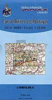
 | 73 - Topographische Landkarte Portugal 1:25.000 Carta Militar de Portugal - Série M888 Instituto Geográfico do Exército (IGeoE) - Portugal |
 | 964-3 LA CAMPANA Amtliche topographische Landkarte 1:25.000 Spanien (M.T.N.) 964-3 Mapa Topográfico Nacional de Espana (MTN25) Instituto Geográfico Nacional - CNIG Spanien |
 | 433-3 Galve de Sorbe Amtliche topographische Landkarte 1:25.000 Spanien (M.T.N.) 433-3 Mapa Topográfico Nacional de Espana (MTN25) Instituto Geográfico Nacional - CNIG Spanien |
 | IT-TOS Toskana ADFC-Radtourenkarte 1:150.000, reiÃ- und wetterfest, GPS-Tracks Download, E-Bike geeignet : Auf in den Süden! Die erste Fahrradkarte der Toskana. Mit allen Radfernwegen und Ergänzungsrouten - BVA BikeMedia GmbH |
 | 612-4 ADEMUZ Amtliche topographische Landkarte 1:25.000 Spanien (M.T.N.) 612-4 Mapa Topográfico Nacional de Espana (MTN25) Instituto Geográfico Nacional - CNIG Spanien |
 | Kaschubei - Kaschubischer Landschaftspark Touristische Landkarte 1:50.000 Laminierte Landkarte Kaszuby Kaszubski Park Krajobrazowy mapa laminowana ExpressMap - Polen |
 | 4213 06 Villala Topographische Karte 1:20.000 (Maastokartta / Peruskartta / Grundkarta) Maanmittauslaitos / Lantmäteriverket Finnland - ProjektNord |
 | 176-3 BAILO Amtliche topographische Landkarte 1:25.000 Spanien (M.T.N.) 176-3 Mapa Topográfico Nacional de Espana (MTN25) Instituto Geográfico Nacional - CNIG Spanien |
 | 3321 09 Pyhäjärvi Topographische Karte 1:20.000 (Maastokartta / Peruskartta / Grundkarta) Maanmittauslaitos / Lantmäteriverket Finnland - ProjektNord |
 | 319-4 ÃGREDA Amtliche topographische Landkarte 1:25.000 Spanien (M.T.N.) 319-4 Mapa Topográfico Nacional de Espana (MTN25) Instituto Geográfico Nacional - CNIG Spanien |
 | 987-2 ISLA REDONDA Amtliche topographische Landkarte 1:25.000 Spanien (M.T.N.) 987-2 Mapa Topográfico Nacional de Espana (MTN25) Instituto Geográfico Nacional - CNIG Spanien |
 | 236-1 FRÃMISTA Amtliche topographische Landkarte 1:25.000 Spanien (M.T.N.) 236-1 Mapa Topográfico Nacional de Espana (MTN25) Instituto Geográfico Nacional - CNIG Spanien |
 | 291-2 LLINARS Amtliche topographische Landkarte 1:25.000 Spanien (M.T.N.) 291-2 Mapa Topográfico Nacional de Espana (MTN25) Instituto Geográfico Nacional - CNIG Spanien |
 | 3623 05 Tulkaselkä Topographische Karte 1:20.000 (Maastokartta / Peruskartta / Grundkarta) Maanmittauslaitos / Lantmäteriverket Finnland - ProjektNord |
 | 249-3 Labata (59-22) Amtliche topographische Landkarte 1:25.000 Spanien (M.T.N.) 249-3 Mapa Topográfico Nacional de Espana (MTN25) Instituto Geográfico Nacional - CNIG Spanien |
 | 388-4 ARTESA DE LLEIDA Amtliche topographische Landkarte 1:25.000 Spanien (M.T.N.) 388-4 Mapa Topográfico Nacional de Espana (MTN25) Instituto Geográfico Nacional - CNIG Spanien |
 | 315 - Topographische Landkarte Portugal 1:25.000 Carta Militar de Portugal - Série M888 Instituto Geográfico do Exército (IGeoE) - Portugal |
 | 0819-2 LA FONT DE LA FIGUERA Topographische Landkarte 1:25.000 Spanien (Grundlage MTN25) Instituto Geográfico Nacional - CNIG Spanien - ProjektNord |
 | 277 Topographische Landkarte Wanderkarte und Fahrradkarte Portugal 1:25.000 277 Mapa topográfico - Mapa de caminhadas - Portugal 1:25.000 ProjektNord |
 | 767-1 ALATOZ Amtliche topographische Landkarte 1:25.000 Spanien (M.T.N.) 767-1 Mapa Topográfico Nacional de Espana (MTN25) Instituto Geográfico Nacional - CNIG Spanien |