| << Spanien: Wanderkarten - ICGC (ICC) - Institut Cartogrà fic i Geològic de Catalunya |
||
|
||

Zuletzt angesehene Artikel:
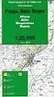
 | Fraga, Baix Segre (Blatt 73) 1:25.000 Aitona, Alfés, Mequinensa, Maials - Wanderkarte Katalonien (Spanien) - Col·lecció Unitats Geogrà fiques - Institut Cartogrà fic de Catalunya |
 | 1518 Südfall - Gestern und Heute - Historische Ãberlagerung 1878-1880 Topographische Landkarte 1:25.000 im Vergleich - Landesvermessungsamt Schleswig-Holstein / ProjektNord |
 | Britisch-Kolumbien Süd 1:900.000 *** SCHNÃPPCHEN *** StraÃenkarte British-Columbia South - Calgary to Vancouver ITMB International Travel Maps (engl.) |
 | 20 Overijssel west - Fahrradkarte 1:66.666 Overijssel west fietskaart Overijssel west - ANWB fietskaart 20 - ANWB - Niederlande |
| 1527 Laboe - Gestern und Heute - Historische Ãberlagerung 1878-1880 Topographische Landkarte 1:25.000 im Vergleich - Landesvermessungsamt Schleswig-Holstein / ProjektNord |
 | Donauradweg Schwarzwald - Regensburg 1:125.000 - Radkarte (Blatt 150) Mit Farbfotos, Kurzführer und Sehenswürdigkeiten. KOMPASS |
 | Umgebung Bielsko-Biala 1:50.000 Wanderkarte / Landkarte Polen Okolice Bielska - Bialej dla aktywniych PLAN Galileos - Polen |
| 1925 Neumünster - Gestern und Heute - Historische Ãberlagerung 1878-1880 Topographische Landkarte 1:25.000 im Vergleich - Landesvermessungsamt Schleswig-Holstein / ProjektNord |
 | Blatt: 42 Schweden-Mitte 1:500.000 - StraÃenkarte - Calazo Förlag Schweden Vägkarta Mellersta Sverige |
 | 201 Parco Nazionale Arcipelago Toscano 1:25.000/1:15.000 Wander-und Mountainbikekartenset (wasser- und reiÃfest) - 4land |
 | Sandezer Beskiden 1:50.000 (Westbeskiden) Topographische Wanderkarte Polen - wasserfeste Ausgabe Beskid Sądecki Compass - Polen |
| 2626SB Dornes - Lucenay-lès-Aix GPS Amtliche Topographische Wanderkarte Frankreich 1:25.000 - série bleue (IGN) |
 | 29 Ferrières - Hamoir - Sy - Barvaux - 1:25.000 Touristische Landkarte und Wanderkarte, Radwanderkarte, Reitkarte - Mini Ardenne - Belgien |
 | Katalonien 1:250.000 StraÃenkarte Katalonien Spanien - ICGC - Institut Cartogrà fic i Geològic de Catalunya Mapa de Carreteres de Catalunya |
 | BACHER StraÃenkarte Deutschland 1:700.000 Wandkarte - beidseitig kaschiert / foliert, mit Alu-Plakatleisten - Format: 98 x 129 cm Bacher-Verlag |
 | 26 Dinant - Maredsous - Houyet - Spontin - Hermeton 1:25.000 Touristische Landkarte und Wanderkarte, Radwanderkarte, Reitkarte - Mini Ardenne - Belgien |
 | Teutoburger Wald 5 - Oerlinghausen - Lippischer Wald Topographische Wanderkarte Nordrhein-Westfalen mit Wanderwegen und Radwegen 1:25.000 - ProjektNord |
 | Pirineu Oriental - Girona - Costa Brava 1:100.000 (Blatt 3) Topographische Landkarte Katalonien Spanien - ICGC - Institut Cartogrà fic i Geològic de Catalunya |
 | Katalonien 1:250.000 Topographische Landkarte Katalonien Spanien - ICGC - Institut Cartogrà fic i Geològic de Catalunya Mapa Topogrà fic de Catalunya 1/250.000 |
 | Västerås - Avesta & Bruksleden 1:50 000 - Fjällkartan - Bergwanderkarte - Calazo Förlag Schweden |