| << Spanien: Wanderkarten - ICGC (ICC) - Institut Cartogrà fic i Geològic de Catalunya |
||
|
||

Zuletzt angesehene Artikel:
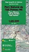
 | Parc Natural de l`Alt Pirineu NE (Blatt 44) 1:25.000 Pica d`Estats, Vall de Cardos, Vall Ferrera - Wanderkarte Spanien - ICC - Institut Cartogrà fic de Catalunya |
 | 25 Hultsfred 1:50.000 (wasserfest) Topographische Wanderkarte - Sverigeserien Topo50 - Schweden Kartförlaget |
 | 57 Ãrebro 1:50.000 (wasserfest) Topographische Wanderkarte - Sverigeserien Topo50 - Schweden Kartförlaget |
 | Sandomir - Stalowa Wola - Tarnobrzeg - Mielec Stadtplan plus 3 1:20.000 Sandomierz Stalowa Wola Tarnobrzeg plan miasta Demart - Polen |
 | 1 Malmö 1:50.000 (wasserfest) Topographische Wanderkarte - Sverigeserien Topo50 - Schweden Kartförlaget |
 | USA Nationalparks I (Band 415) 23 unvergessliche Wanderungen in Kalifornien und Arizona - von Regina Stockmann - Conrad-Stein-Verlag |
 | Blatt 9A: Sant`Antonio in Val Vogna - Formazza 1:50.000 - Wanderkarte - Sentiero Italia Piemonte CAI - 4land / Idea Montagna Carta itineraria del Sentiero Italia tratto piemontese, da Sant`Antonio in Val Vogna a Formazza 4land / Idea Montagna |
 | Madrid - City Pocket + The Big Five laminierter Mini-Stadtplan 1:10.000 Touristische Informationen, U-Bahn, StraÃenverzeichnis - freytag & berndt |
 | 2 Lombardei - Como, Mailand, Brescia Reisekarte Italien 1:200.000 - Kümmerly & Frey Lombardia - Como, Milano, Brescia |
 | Südafrika - Digitale Topographische Karten 1:50.000 auf 6 DVDs Landkarte Topographic Sheets of South Africa Mapstudio Südafrika |
 | 33-559 Eifelwandern 8 - Blankenheim, Nettersheim 1:25.000 - Dahlem, Eicherscheid, Kall, Marmagen, Schmidtheim - Wanderkarte mit Radwegen - NaturNavi |
 | Spanien & Portugal - englisch Laminierte PLANO-Karte 1:1.8 Mio. (Format: 83 x 55 cm) - gerollt im Plastikrohr Spain & Portugal flat map - laminated National Geographic |
 | Yellowstone / Grand Teton National Parks (201, 202) 1:31.680 / 1:80.000/ 1:126.720 Landkarten-Set (2 Karten) - Trails Illustrated Maps - National Parks USA National Geographic |
 | Berlin 1945 - 1989 Pastfinder (englische Ausgabe) Stadtführer zu den Spuren der Vergangenheit - von Maik Kopleck - Pastfinder |
 | 11 Södra Gotland 1:50.000 (wasserfest) Topographische Wanderkarte - Sverigeserien Topo50 - Schweden Kartförlaget |
 | Alto Appennino Cesenate (Blatt 10) - Touristische Wanderkarte 1:50.000 Carta escursionistica Regione Emilia-Romagna / Club Alpino Italiano - Italien |
 | Risnjak (Blatt 35) Topographische Wanderkarte 1:25.000 - Serija Dinarske Alpe Risnjak - Serija Dinarske Alpe - Mountaineering and Hiking map - Croatian Mountain Rescue Service Kroatischer Bergrettungsdienst - Kroatien |
 | Lesbos (Blatt 334) Landkarte Griechische Inseln 1:105.000 Orama - Griechenland Λέσβος - Lesvos |
| Gilroy / Morgan Hill / Hollister Stadtplan 1:32.000 (Kalifornien - USA) Gilroy / Morgan Hill / Hollister street map GM Johnson |
 | CORSE-DU-SUD (Blatt D2A) Département-Landkarte Frankreich 1:100.000 CORSE-DU-SUD - Carte départementale - IGN Frankreich |